MILWAUKEE – A Winter Storm Watch has been posted for all of southeast Wisconsin from 6 a.m. Thursday, Dec. 22 through 6 a.m. Saturday, Dec. 24. A blizzard continues to look likely across the area.
Monitor the FOX6 Weather Experts forecast for frequent updates.
Winter Storm Watch 6am Thursday to 6am Saturday
Forecast breakdown
Timeframe: Light, scattered snow Wednesday evening into Thursday morning. Snow really picks up Thursday afternoon and evening. Heaviest snow expected Thursday night into Friday morning. The wind will pick up Thursday afternoon and really get strong after 6pm Thursday with NW wind gusts to 30-60mph. Blizzard conditions possible at times Thursday night through Friday. It is not looking as snowy Friday, but blowing and drifting snow continues Friday and Saturday.
Amounts: The snow totals have come down, but this does not change the blizzard potential. 4-8″ of snow possible across much of southeast Wisconsin. The heavier Friday snow has moved east. This is lowering totals, however, a change in the storm track could keep snow going in SE WI on Friday. As of this post, the heaviest snow Friday is about 50 miles east over the lake. Snow totals could go up if the low moves west. Stay tuned for updates.
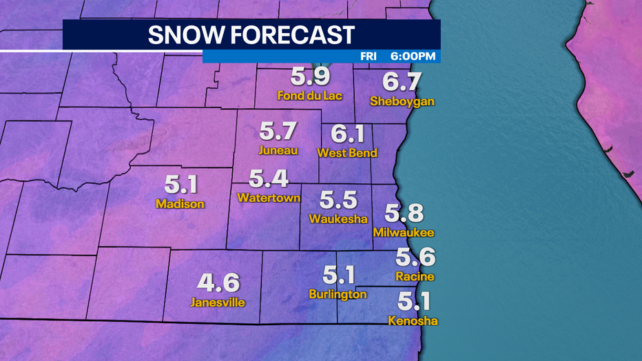
Snow Forecast now 4-8″. Blizzard conditions still expected Thursday night/Friday Morning
Impacts: Travel will be difficult Thursday night into Friday. The strong winds continue on Saturday with blowing ground snow. Bitter cold air spills in on Friday with wind chills as low as -25 Friday night, Saturday and Sunday morning.
Snow Type: This snow could start out as the wetter variety on Thursday but quickly become fluffy late Thursday night into Friday.
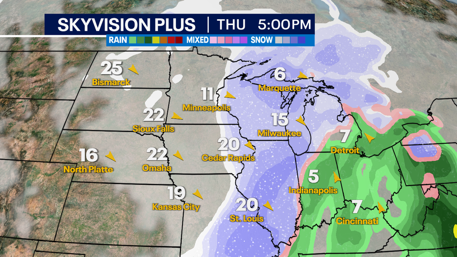
Thursday 5pm Forecast. Wind getting stronger with moderate snow.
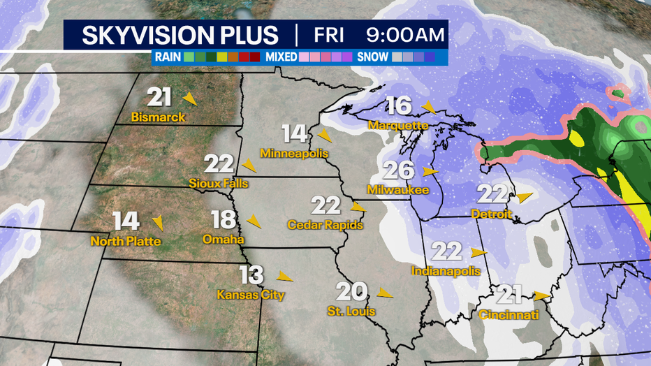
Friday 9am Forecast. Snow tapering off with very strong winds.
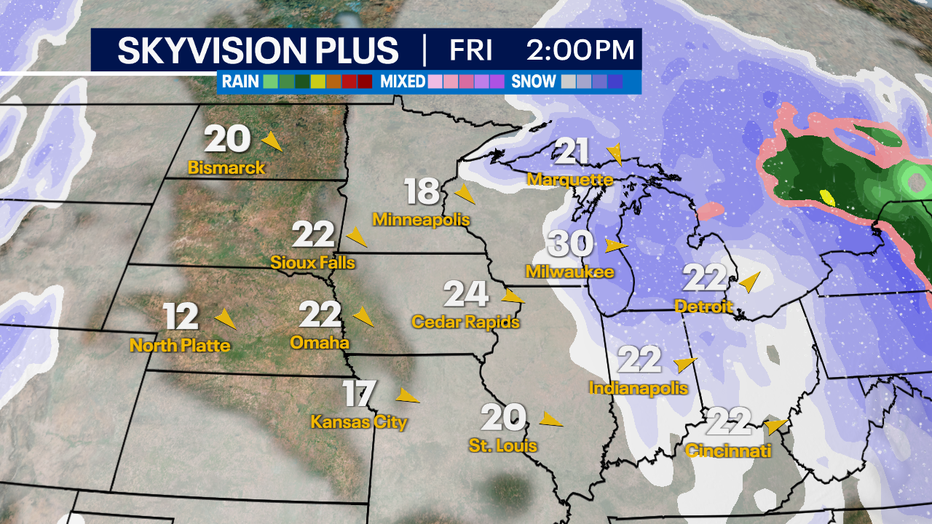
Friday 2pm Forecast. Heaviest snow just east. Light snow & strong winds in SE WI.
A blizzard is defined as heavy snow with wind gusts of 35 mph or greater and reduced visibility to 0.25 mi. or less for three hours or more. The last Blizzard Warning in SE WI (Walworth, Racine & Kenosha Co.) was in 2018. The last Blizzard Warning for Milwaukee County was 2011.
The wind will really pick up Thursday night into Friday creating these blizzard conditions. Expect significant travel delays both by air and car on Thursday evening and Friday. If you have plans to travel by air, stay up to date with your airline. It is possible to see power outages and interstate closers in parts of the upper Midwest Thursday night and Friday.
Stay weather aware
Meanwhile, FOX6Now.com offers a variety of extremely useful weather tools to help you navigate the stormy season. They include the following:
FOX6 Storm Center app
FOX6 News app
FOX Weather app
MAPS AND RADAR
We have a host of maps and radars on the FOX6 Weather page that are updating regularly — to provide you the most accurate assessment of the weather. From a county-by-county view to the Midwest regional radar and a national view — it’s all there.
SCHOOL AND BUSINESS CLOSINGS
When the weather gets a little dicey, schools and businesses may shut down. Monitor the latest list of closings, cancellations, and delays reported in southeast Wisconsin.
