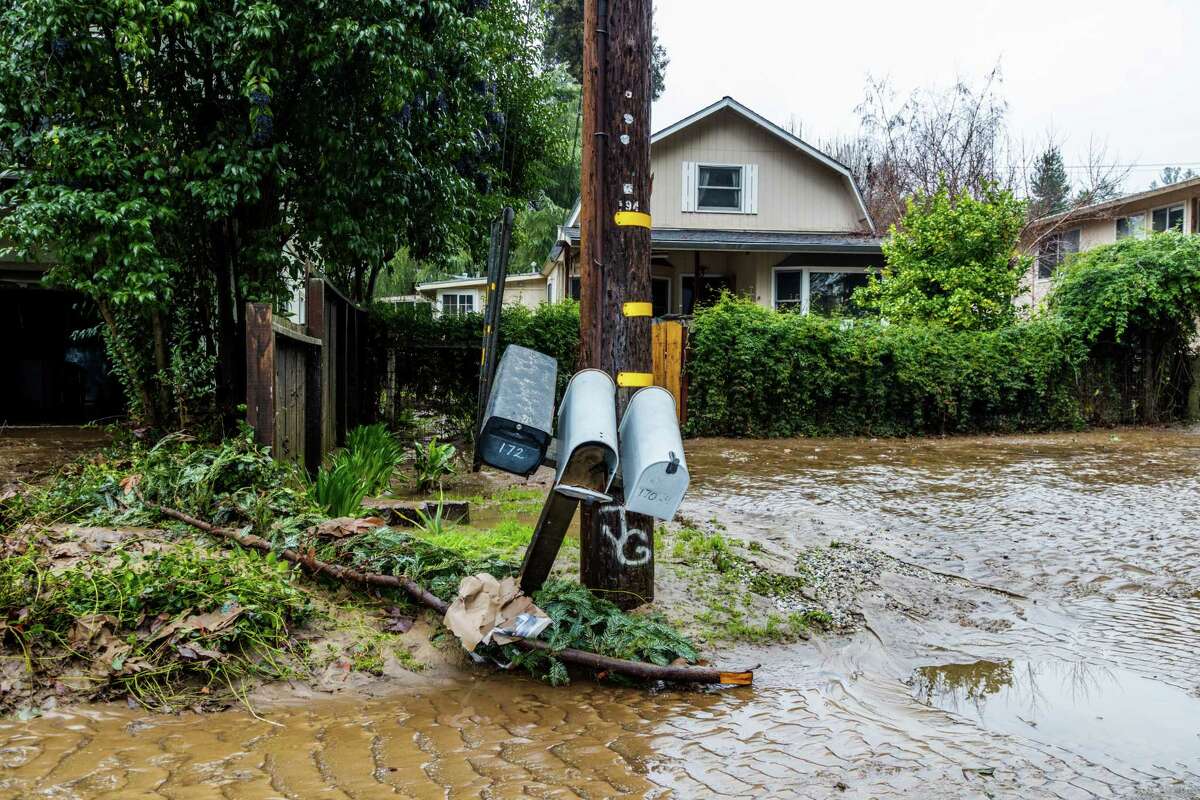
Intense storms continue to slam into California, bringing near-historic levels of rain in many regions. The San Francisco Bay Area woke up to an intense hail storm on Tuesday morning, with reports of overnight thunder and lightning across the region, and The National Weather Service has issued a flash flood warning until 3 p.m. for San Francisco, Daly City, and South San Francisco. Damages from flooding and high winds have been widespread, and are expected to worsen after last night’s gales.
The list of flooded communities, evacuations, mudslides, downed trees and road closures continued to grow Monday, with more rain and high winds expected through Tuesday. In addition to the possibility of isolated thunderstorms, the conditions created a risk of landspouts and weak tornadoes.
Residents in the Santa Cruz Mountains received the brunt of the active weather as strong winds and heavy rainfall added stress on already saturated soils. The San Lorenzo River flooded earlier than expected, reaching its second highest water level since record keeping began in 1937.
Latest updates:
Evacuation for Spreckels in Monterey County
People in the Spreckels community outside of Salinas are being ordered to evacuate due to storm conditions, with evacuation warnings now upgraded to mandatory, the Monterey County Sheriff tweeted. Included are businesses at the intersection of Highway 68 and Spreckels Boulevard, effective immediately. The community is along the Salinas River.
Muni service back for some lines after tree-falling incident | 2:25 p.m.
The southbound 8, 30 and 45 buses are back to regular service following a temporary rerouting after a large tree fell on a Muni bus on Sutter Street at the corner of Stockton. A Muni spokesman says the northbound 30 and 45 and southbound 15 are still being rerouted.
2 rescued when tree falls on vehicle in S.F.’s Richmond District
Two people were rescued when a tree fell on a vehicle near Golden Gate Park, but they “will be OK,” the San Francisco Fire Department said. The incident happened at Fulton Street and 19th Ave, and people are advised to avoid the area. the department said.
No injuries when massive tree fell, says Muni | 2 p.m.
No one was injuried when a towering tree crashed atop a Muni bus near Stockton and Sutter streets Tuesday in downtown San Francisco, Muni spokesman Stephen Chun told The Chronicle. There was no estimated time for when the area would reopen to traffic.
Muni bus lines affected by toppled tree | 1:30 p.m.
San Francisco transportation officials said Tuesday that transit bus lines 8/8AX/8BX, 15, 30 and 45 have been affected by the falling of a large tree that toppled on top of a bus near Sutter and Stockton streets in downtown and crashed across the rain-slicked traffic lanes. Muni officials could not immediately be reached for comment, but tweeted that southbound service is being rerouted via Columbus Avenue to Montgomery Street to Market Street to Fourth Street, according to Muni officials. Northbound service is rerouted via Kearny Street to Columbus back to the regular route.
S.F. to get a break from severe weather
The bulk of the thunderstorms is spreading inland. Brief, weaker thundershowers will be possible in SF through the next 2 to 3 hours before things finally settle down, Chronicle meteorologist Gerry Diaz reports.
BART is running slow in storm conditions
BART says high winds, heavy rain and hail have caused the trains to run at lower speeds. The transit agency urged riders on Tuesday to add extra travel time.
Tree falls on bus in downtown S.F.
A large tree uprooted and fell near the Stockton parking garage in downtown S.F., landing on top of a MUNI bus and appearing to block traffic, on Tuesday, January 10, 2023.
Provided by Owen ThomasA large tree uprooted and fell near the Stockton parking garage in downtown San Francisco, landing on top of a MUNI bus and appearing to block traffic.
Storms to shift northward on Wednesday
A majority of Tuesday’s storms impacted southern and central California but the extreme weather pattern is expected to shift north on Wednesday, according to an update from the National Weather Service.“We will continue to see some moderate precipitation about San Francisco northward,” said meteorologist Eric Schoening, who forecast 1 to 3 inches of rain for the region. “For areas across the southern half of the state, you’re going to see a break in the rain.”
Alameda urges residents to stay off the roads as thunder, lightning and hail pummel the area
The city of Alameda urged residents to stay off the roads and out of city parks as the city saw lightning, wind, rain and hail. For regular storm updates, click here.
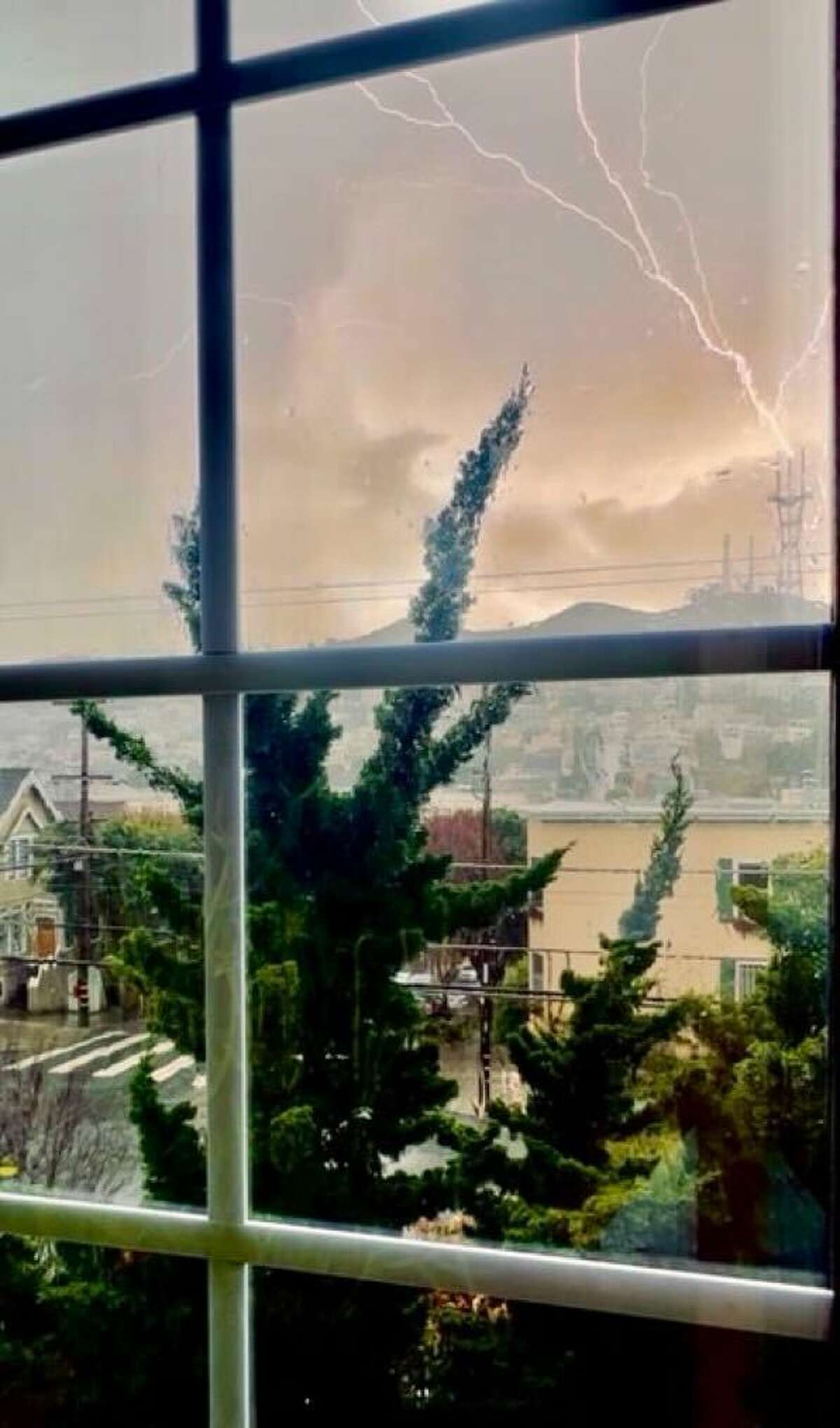
Lightning flashes above San Francisco
Lightning has now joined the mix of weird weather for the Bay Area. After hail was reported pounding the pavement around downtown and other areas, lightning flashed in the sky shortly before 1 p.m. Monday. The National Weather Service has issued a flash flood warning until 3 p.m. for San Francisco, Daly City, and South San Francisco. Residents are advised to move to higher ground and avoid walking or driving through flood waters. The warning impacts over 1.1 million people, 165 schools, and 16 hospitals.
Caltrans urges people to stay off roads
Amid severe weather impacts across Northern California, the state’s transportation agency on Tuesday urged people to stay off the roads. “Travel highly discouraged for unsafe conditions,” Caltrans tweeted.
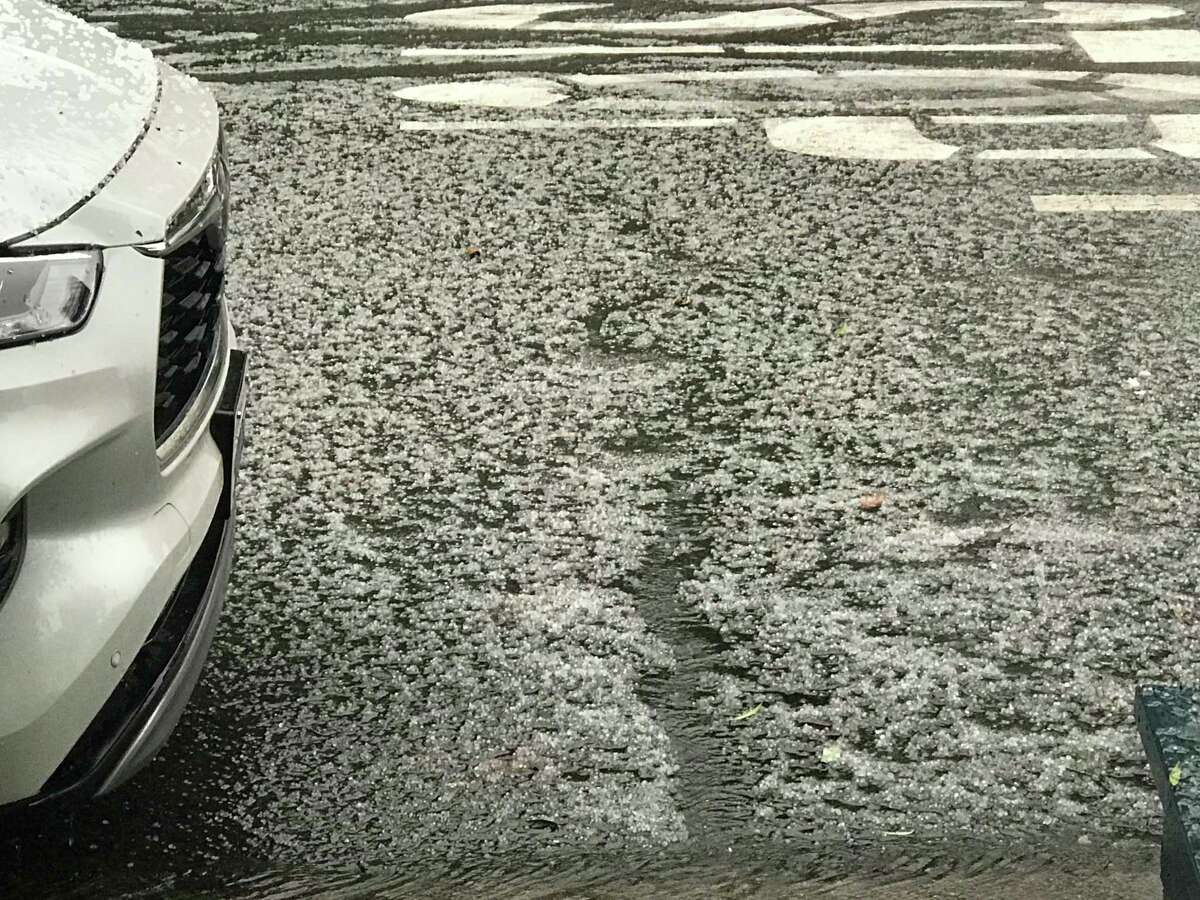
Hail pounds S.F., East Bay
Shortly after San Francisco blasted out an emergency flood alert, hail began pounding down on the city and on Oakland across the bay, stirred up by strong winds.
San Francisco issues flash flood warning alert
Phones blared in San Francisco with “Emergency Alert: A Flash Flood warning is in effect for this area until 3:30 p.m. PT.”
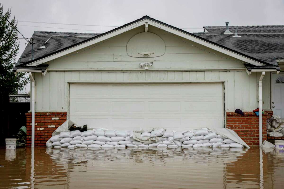
Hundreds of homes damaged in Santa Cruz County
Some 300 homes have been damaged by rising floodwaters in the Watsonville area, according to Ray Cancino, CEO of Santa Cruz County nonprofit Community Bridges, an organization providing aid throughout the region. Those impacted are predominately residents in low-income senior housing. Some of those properties are so severely flooded and damaged that elderly residents have not been able to return home, Cancinco said, despite floodwaters dissipating and the bulk of evacuation orders being downgraded to warnings.
Next round of storms rolling into San Francisco
The next round of thunderstorms are rolling into San Francisco and slated to bring scattered lightning, small pea-sized hail, strong winds gusting to 35 mph and heavy downpours.
Satellite video shows atmospheric river walloping California
The NOAA Satellite service on Tuesday posted a timelapse video loop showing the atmospheric river events hitting the West Coast between Jan. 6 to Tuesday.
Lightning strikes Sutro Tower
Lightning strike Sutro Tower on Tuesday, January 10, 2023.
Provided by Daniel HaireSutro Tower in San Francisco suffered a lightning strike shortly before noon Tuesday, according to radar data.
Thunderstorm warning for Northern California: “Go indoors”
The National Weather Service on Tuesday warned that thunderstorms will likely roll across the interior regions of Northern California between noon to 8 p.m., with potential impacts that include lightning, heavy rain, small hail, gusty winds, and even brief tornados. “When thunder roars, go indoors!” the agency said.
Oakland, Berkeley, Sea Ranch warned of high wind and hail | 11:51 a.m.
The National Weather Service warned that Oakland, Berkeley, Concord and Sea Ranch could get 50mph winds and pea-sized hail. The agency urged residents to seek shelter “in a sturdy structure.” The warning is in effect until Tuesday at 12:15 p.m.
Bay Area radar shows thunderstorm rolling into San Francisco | 11:45 a.m.
A strong thunderstorm cell is quickly heading toward Daly City and the west side of San Francisco. Biggest impacts will be heavy downpours and the chance for small hail, gusts over 35 mph and occasional lightning.
I-80 in Sierra Nevada closed due to strong winds, whiteout conditions | 11:39 a.m.
A portion of Highway 80 in Truckee was closed Tuesday because of whiteout weather conditions that make it difficult to drive, the California Highway Patrol said. Westbound lanes at the California-Nevada border and eastbound lanes at Colfax will be closed indefinitely.
Gov. Newsom to survey Santa Cruz County storm damage
Gov. Gavin Newsom is planning to visit storm-impacted areas in Santa Cruz County on Tuesday. His media team said Newsom will discuss storm response and recovery with local and state officials.
Evacuation warnings for Russian River lifted
The Sonoma County Sheriff’s Office said Tuesday morning that all evacuation warnings for the areas along the Russian River have been lifted. The agency warned residents of flooded creeks, downed trees and road closures, but said no evacuation orders or warnings are in place for the area.
Storm blows off portion of roof in South S.F.
Did the storm blow off a roof of an apartment complex in South San Francisco? Kind of.
Around 2 a.m. Tuesday, winds kicked up in San Mateo County with reported wind gust of up to 70 mph at San Francisco International Airport. S
hortly after, 911 callers reported that roof damage at a four-unit complex on Susie Way in South San Francisco, said Matt Samson, the city’s deputy fire chief.
Upon arrival, crews discovered that wind removed the outer layer of the roof – which Samson referred to as the water-proofing membrane.
“It’s a flat roof,” Samson said. “Then on top of that is a water proofing membrane that keeps the rain out and that’s what was separated. Crews arrived and made sure all the residents were safe and were able to evacuate them out the building without any injury.”
The residents of the two units on the bottom floor were able to return to their units, but 10 residents of the two upper units were moved to a shelter due to water damage, Samson said.
California death toll reaches 15, state officials say
The number of people who have died from the winter storms pounding California rose to 15 on Tuesday, according to governor’s Office of Emergency Services. The number of storm-related deaths rose from Monday, when Gov. Gavin Newsom announced 14 people had been killed.
San Francisco rains reaching historic levels
The 12.37 inches of rain that fell in San Francisco from Dec. 26 through Jan. 9 made for the city’s third-wettest 15-day period since the Gold Rush, according to Bay Area meteorologist Jan Null. Rains in 1862, which produced a megaflood that drenched the state, produced a staggering 19.77 inches in just 15 days.
Search for 5-year-old boy swept away by flood waters called off
Rescuers have ended the search for a 5-year-old boy who was swept away by floodwaters in central California Monday morning, the Associated Press reports. A roughly 7-hour search for the missing boy turned up only his shoe before officials called it off as water levels were too dangerous for divers, officials said. The boy has not been declared dead, said spokesperson Tony Cipolla of the San Luis Obispo County Sheriff’s Office. The boy’s mother was driving a truck when it became stranded in floodwaters just before 8 a.m. near Paso Robles, a small city inland from California’s central coast, according to Tom Swanson, assistant chief of the Cal Fire/San Luis Obispo County Fire Department. Bystanders were able to pull the mother out of the truck, but the boy was swept out of the vehicle and downstream, likely into a river, Swanson said. There was no evacuation order in the area at the time.
‘Travel is not advised’ in Yosemite:
Several roads are closed in Yosemite National Park, including Wawona Road (Highway 41) between Wawona and Yosemite West — with no access to Yosemite Valley via Highway 41, according to the National Park Service.
Outside the park, Highway 140 is closed between Midpines and El Portal. Big Oak Flat Road (the continuation of Highway 120 from the west) is open, the park service said, but it added that “Travel is not advised. Road conditions may change quickly.”
People should bring chains if they are visiting the park, and can call 209-272-0200 for the latest information on road closures.
Storms keep many East Bay parks closed
The East Bay Regional Park District reported that most regional parks remain closed due to the storm. However, some parks along the bay shoreline and delta have reopened. For a full list, click here.
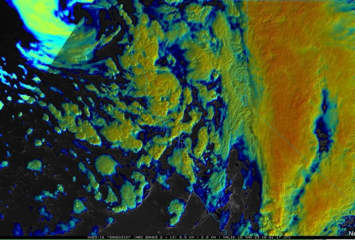
Eye of the storm on satellite imagery this morning
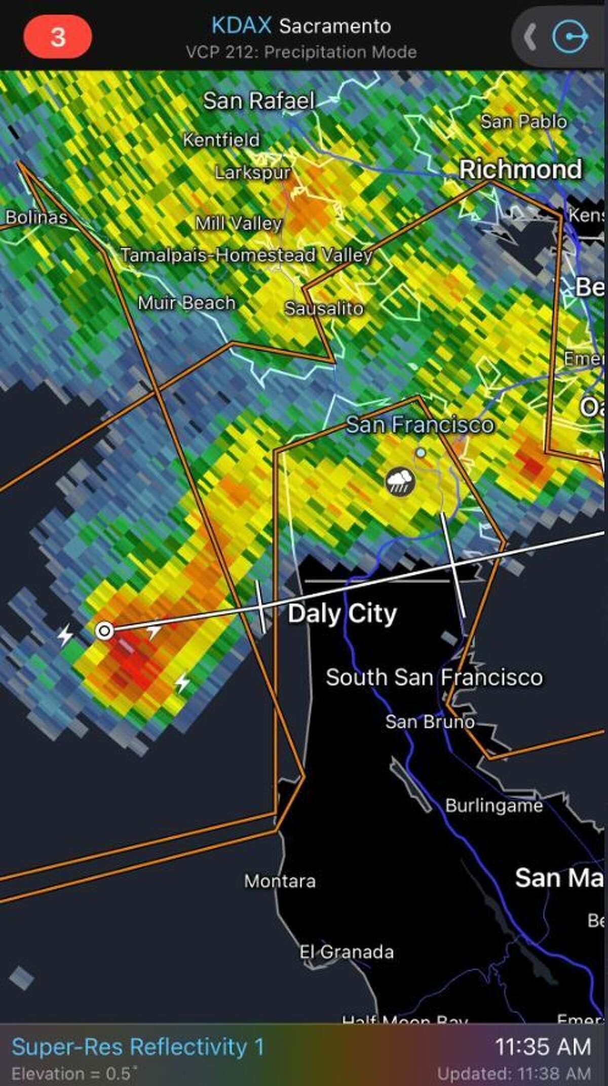
Radar images showed strong thunderstorm cell quickly heading toward Daly City and the west side of San Francisco.
RadarscopeThe heart of the storm responsible for today’s intermittent thunderstorms and their heavy rainfall, strong winds and hail is sitting off the coast of Eureka this morning. Satellite imagery off GOES-West shows that more thunderstorm cells are pinwheeling their way into Bay Area this morning, prompting the NWS Bay Area to issue more special weather statements to the Peninsula and San Francisco. These cells will continue into the rest of the morning and early afternoon hours.
Sierra pummeled by snow
Nearly 36 inches of snow is expected to fall in the Sierra over the next day, according to the U.C. Berkeley Central Sierra Snow Lab. That’s on top of the 9 inches of snow that just fell in the region over the past 24 hours. The lab recorded 172% of average precipitation and 178% of average snow water equivalent. Over the next 24 hours, snowfall rates are expected to increase and between 18 to 36 inches are expected over the next day, according to the lab.
Storms snarl Santa Cruz County highways | 9:32 a.m.
Here is a list of highways currently closed in Santa Cruz County, according to the California Highway Patrol. Estimated times for reopening were not immediately available.
- State Route 9 at Keystone Way
- State Route 9, between Glen Arbor Road and Holiday Lane
- State Route 9, north of State Route 236
- State Route 9 at Lazy Woods Road
- State Route 35 at Bear Creek Road
- State Route 236 at Little Basin Road
Massive cleanup underway in Santa Cruz County
About 20,000 people were without power in Santa Cruz County on Tuesday morning, and multiple trees and power lines were impacting roads, said county spokesperson Jason Hoppin. No injuries have been reported, he said.
Wind, hail warning for S.F, Oakland, Concord
The National Weather Service issued a special weather statement for San Francisco, Oakland and Concord warning of the possibility of pea-sized hail and winds of up to 40 miles per hour. The statement is in effect until 9:45 AM.
This map shows where hundreds of S.F. trees have fallen
A wave of recent storms brought heavy winds and rainfall to the Bay Area, causing flood damage and power outages. Data shows that San Franciscans are also dealing with a huge spike in fallen trees as a result of recent inclement weather.
Extreme winds from the atmospheric river storm last Wednesday downed numerous trees, disrupting traffic and disabling electrical lines.
Data from the city’s 311 database shows that the highest number of reports were made on Wednesday, Jan. 4, at 114. The following day, 78 reports about fallen trees were called in. Read more here about reported fallen trees in San Francisco.
Russian River avoids flood levels
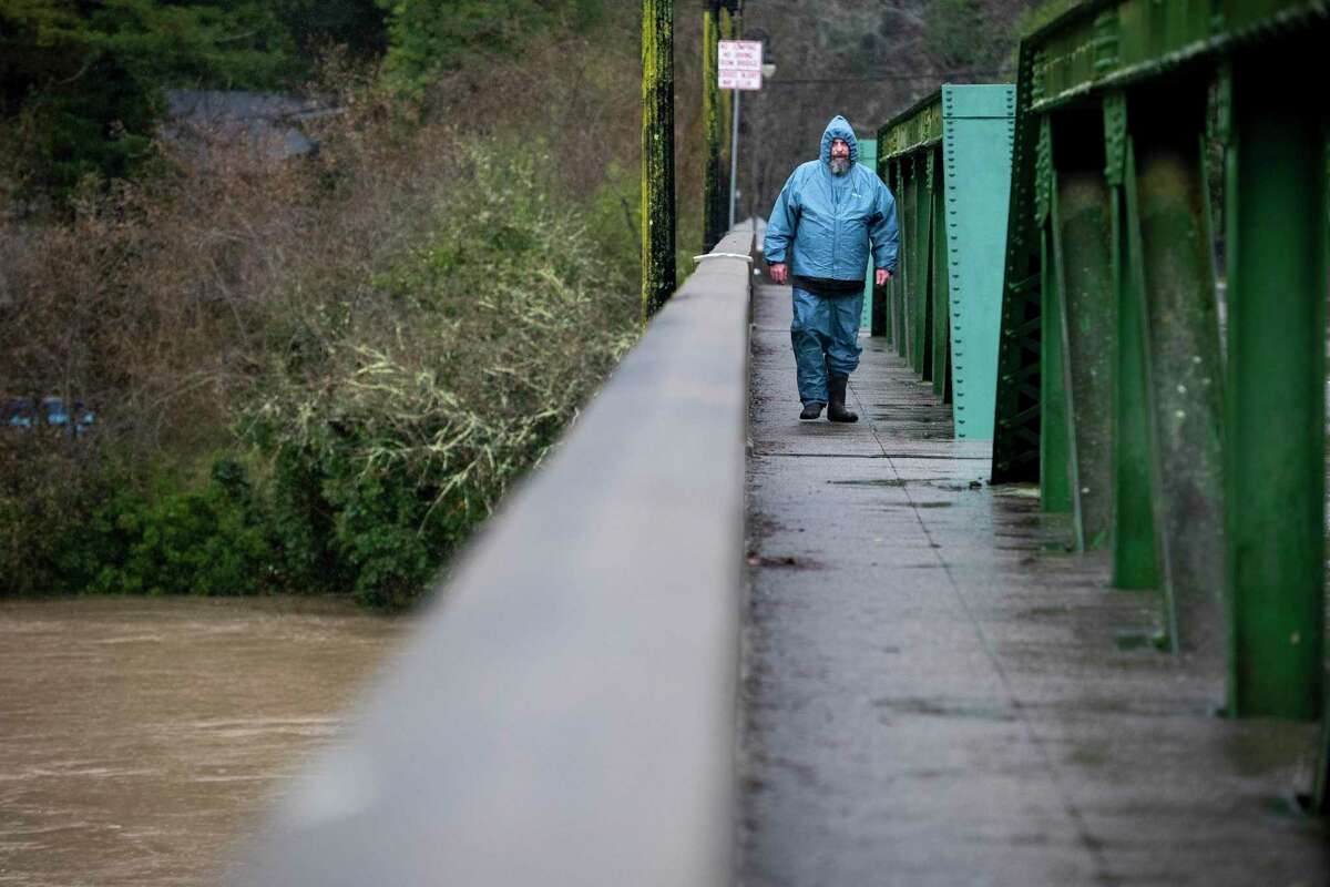
Jack Raschke of Monte Rio walks across the Monte Rio Bridge to look at the Russian River flooding on Tuesday.
Marlena Sloss, Freelance / Special to The ChronicleA series of atmospheric rivers took more southerly routes than predicted, dumping far less rain on the North Bay region so far this week. Models show the Russian River crested about 5 a.m. today just below flood stage at 31.8 feet.
But with more rain in the forecast, people should remain alert, said National Weather Service meteorologist Cindy Palmer. Mudslides, falling trees and some flooding are still major risks given that the ground is is saturated and the creeks are overly full.
“We’re going to be monitoring the rivers streams and creeks closely,” Palmer said. “We are not out of the woods just yet.”
Thousands still without power in Bay Area | 9:02 a.m.
Pacific Gas & Electric Co. reported that thousands of customers throughout the Bay Area were still without power. Power outages impacted more than 5,300 customers in Sonoma County – the highest in the Bay Area. Across Northern California, about 93,000 customers were without power as of Tuesday morning, with nearly 22,000 in the Central Coast.
Here is the breakdown of all Bay Area counties:
- Marin County: 4,382 customers
- San Mateo County: 3,479 customers
- Alameda County: 840 customers.
- Solano County: 609 customers.
- Contra Costa County: 550 customers.
- Santa Clara County: 547 customers.
- Napa County: 18 customers.
Monterey County issues evacuation order for Salinas River region
The Monterey County Sheriff issued an evacuation order for residents in the low-lying areas of Salinas River early Tuesday morning due to flooding The order for the areas surrounding San Ardo and San Lucas is in effect until further notice.
Transit experiencing storm-related delays
Caltrain said Tuesday morning it was experiencing delays up to 30 minutes because of the storm weather conditions. BART riders should also expect slower trains and up to 20-minute delays, officials said.
Isolated thunderstorms continue to roll into the Bay Area this morning
Thunderstorms with 35 to 55 mph gusts, heavy downpours and small hail are dotting the Bay Area this morning as the storm begins to make landfall on the Eureka Coast.
This means that most cities in the region will experience thunderstorm activity through the rest of the morning and into the early afternoon.
Wind and hail advisory for parts of East Bay
Satellite images showed thunderstorms with 35 to 55 mph gusts, heavy downpours and small hail are dotting the Bay Area this morning.
GOES-West Satellite ImageryThe National Weather Service on Tuesday morning issued a special weather advisory for Antioch, Livermore and Pleasanton, warning of 40-mile-per-hour winds and hail.
S.F. residents urged to avoid these areas due to “obstructions”
San Francisco is asking the public to avoid several intersections due to “obstruction,” likely from storm-related damage, according to AlertSF.
- Union Street / Hyde Street
- Mission Street / Van Ness Avenue
- Pierce Street / Post Street
- Area near 122 Guerrero Street
- Mission Street and Van Ness Avenue
- Area near 155 Fell Street
Highway 9 in Santa Cruz closed due to downed tree
A seven-mile stretch of Highway 9 was closed Tuesday morning due to a downed tree, Caltrans officials said. The highway is closed approximately seven miles north of Santa Cruz, and it was not immediately known what time it will reopen.
Power outages forces school closures in South Bay
Los Gatos High School and Saratoga High School in Santa Clara County will be closed Tuesday due to power outages at both campuses, school officials said.
Bay Area rivers under monitor stage
Forecasters are monitoring several rivers across the Bay Area as storms continue to hit California. The Russian River in Guerneville was in “monitor” stage on Tuesday morning, just below the flood stage, and is expected to gradually diminish, said National Weather Service meteorologist Brooke Bingaman.
The Pajaro River in Monterey County is also in monitor stage. But forecasters predict the water levels will rise on Wednesday, when another round of rain and strong winds are expected to return to the region after a brief break from wet weather on Tuesday evening, the NWS said.
Evacuations ordered in Merced County town
The entire town of Planada in Merced County was ordered to evacuate on Tuesday morning, according to the Merced County Sheriff’s Office. There is a shelter available at the Merced County Fairgrounds, officials said. Residents were urged to avoid unnecessary travel.
Planada, east of Merced, has a population of about 4,100 people.
“It felt like our house was gonna blow away”
People in Northern California were woken up starting around 2 a.m. by intense rain and, in some cases, thunder.
From Oakland to the Tri-Valley to San Francisco, people on social media said the sounds and sights of the storm were like nothing they had seen before.
In the East Bay, one Reddit user wrote: “That might have been some of the hardest hitting rain I’ve ever heard.”Others also woken up by the storm concurred: “It had me looking out the window thinking ‘what would happen if that tree fell on the house?’ I’ve never heard wind like that before.” Another user wrote they “saw and heard one intense lightning/thunder and it felt like our house was gonna blow away.”
A Campbell resident said a redwood tree uprooted and fell into the corner of their building: “This is where our bedroom is, so we’ve moved to our spare. Not sure what the extent of the damage is, but it’s holding for now. I imagine that this will take days to have removed.”
Hail reported in San Francisco
A storm system moving across the Bay Area early Tuesday morning brought hail to San Francisco, according to multiple reports.
Wind gust blasts SFO
A wind gauge at San Francisco International Airport measured a gust at 69 mph, according to an automated wind-speed alert.
Storms on Tuesday were expected to bring another round of powerful wind, rain and even hail storms to the Bay Area.
PG&E outages: 189,000 customers without power
About 189,000 Pacific Gas & Electric Co. customers were without power Tuesday morning after the latest round of winter storms pounded the Bay Area and the Central Coast, according to the utility company.
“The storm activity included wind gusts exceeding 70 mph and more than 100 cloud to ground lightning strikes as of 5:30 a.m.” Tuesday, PG&E said in a morning update.
Morning storms could bring hail to parts of Bay Area
The next storm system set to rake across the Bay Area is expected to bring scattered thunderstorms Tuesday, along with gusty winds and even small hail, according to a forecast from the National Weather Service.
The storms are likely to lose steam throughout the day and taper off Tuesday evening, NWS said. “Another round of rain and gusty winds appears on tap for Wednesday, then drier conditions as we head into the latter part of the week,” NWS meteorologists wrote.
How high will rainfall totals be in the Bay Area?
Rain totals will likely tally around 1 to 2 inches in most of the Bay Area, says Chronicle meteorologist Gerry Díaz says, while the mountains could see as much as 4 inches as thunderstorms rain themselves out between valleys. It goes without saying that the additional rain and the strong winds from all these thunderstorms will only add to the stress on soils that are filled to the brim with moisture, along with the risk for debris flows as oversaturated trees fall over.
Tuesday’s weather forecast
Monday night’s thunderstorms will carry over into Tuesday morning, bringing rounds of heavy downpours, lightning and strong winds to the Bay Area and Santa Cruz Mountains. Unlike recent storms, Tuesday’s setup will host on and off rounds of heavy rainfall. This means that there will be places across the Bay Area where breaks in the rain might last anywhere from a couple minutes to a couple hours, depending on how many thunderstorm cells end up forming.
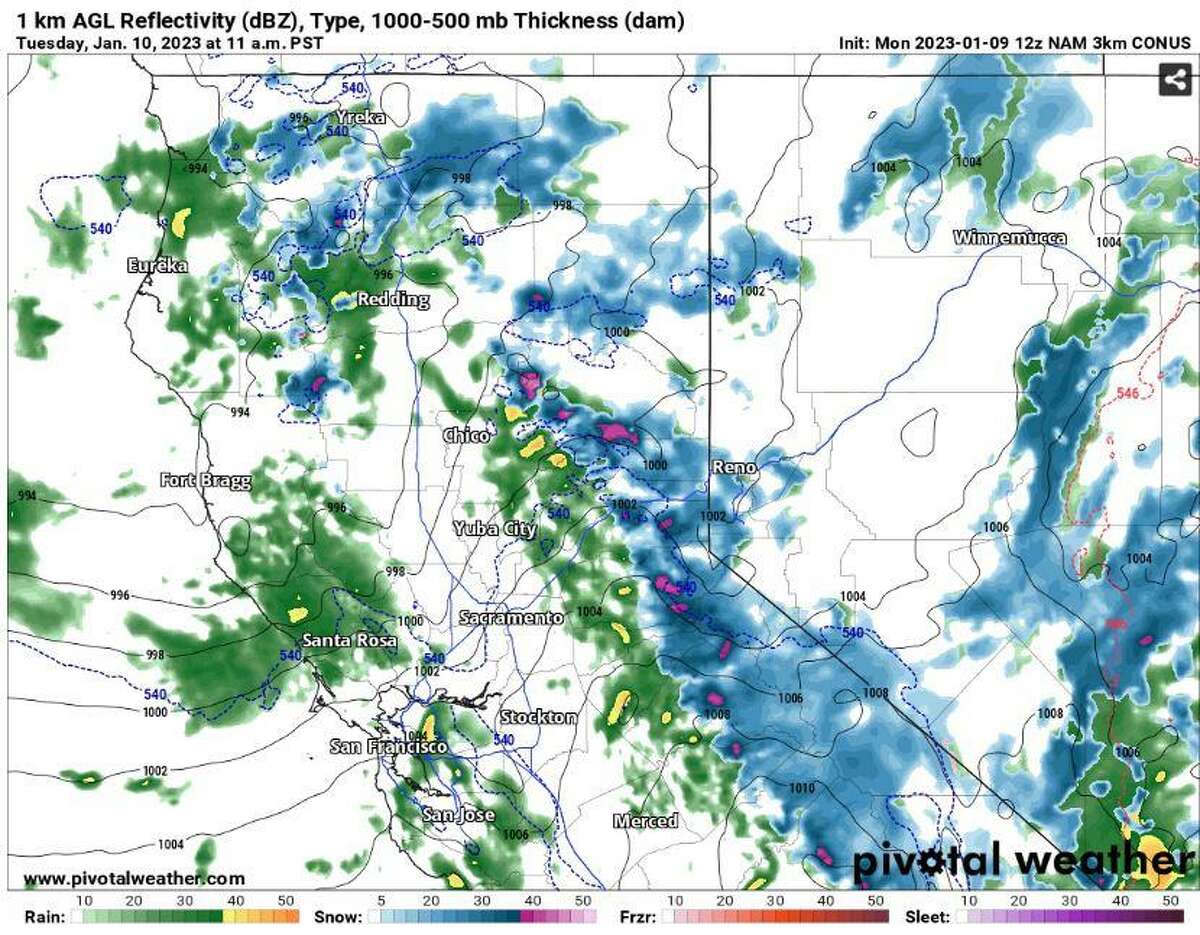
The North American weather model’s forecast for rain bands keeps them disorganized over the Bay Area, which is a strong signal for the isolated thunderstorms that will likely circle portions of the coast, San Francisco Bay and the mountains this morning and into the early afternoon hours.
Diaz, Gerry / Pivotal WeatherGo here for the full weather forecast for each Bay Area region.
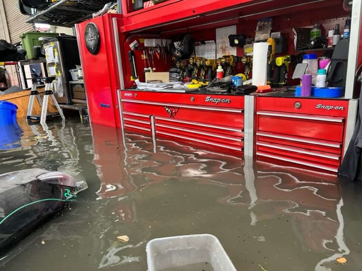
Dozens of Teslas and other high-end cars ruined by storm flooding at S.F. repair shop
More than a week after the epic New Year’s Eve storm sent waist-high waters coursing through Alioto’s Garage on Folsom Street in San Francisco, the garage is still cleaning up – but 40 Tesla, Porsche and other pricey cars that got flooded are a total loss. Garage co-owner Matt Alioto said the local storm drain backed up in the storm and turned his repair shop into a little lake so fast that he and his staff couldn’t move the automobiles out of harm’s way. “We’ll probably be cleaned up enough to start taking cars in by the end of this week, or next week, but the damage is in the hundreds of thousands of dollars,” Alioto told The Chronicle.
Alioto’s Garage in San Francisco lost thousands of dollars worth of pricey cars to storm damage.
provided by Matt Alioto Jan. 9, 20223
Provided by Matt AliotoPhotos and video of Santa Cruz county damage
Sewage overflows into San Francisco Bay and city streets
Millions of gallons of storm water mixed with raw sewage made its way into creeks, the bay and city streets during recent heavy rainstorms that overwhelmed dozens of Bay Area sewers and some treatment plants.
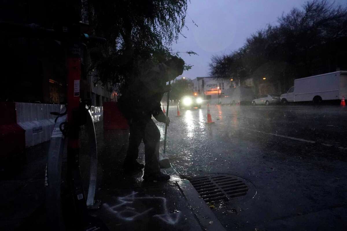
A resident watches as water flows into a sewage drain in San Francisco on Jan. 4.
Jeff Chiu, STF / Associated PressSome raw sewage seeped out of manholes or backed up sewer drains, calling into question even the idea of kids splashing in their rainboots.
“Don’t jump in puddles. Especially in San Francisco — you want to be careful that there (could be) sewage in that,” said Eileen White, executive officer of the San Francisco Bay Regional Water Quality Control Board, referring to flooded areas when the city’s unique sanitary system that combines storm water and wastewater is backed up during heavy rain.
Read more about sewer overflows across the Bay Area.