Severe storms – with reports of at least one tornado and damaging winds – are raking parts of Oklahoma and Texas, leaving a trail of damage Tuesday morning and threatening more as blizzard conditions build across several states farther north.
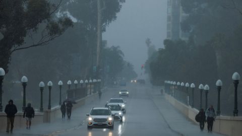
This is all part of a giant winter storm system pushing into the central US after walloping the West over the weekend. About 25 million people from Texas to Mississippi are under threat of severe storms Tuesday, including tornadoes. And about 15 million people – largely in the north-central US – are under winter-weather warnings or advisories Tuesday morning, with power outages a key concern.
Two tornado watches are in effect: One for parts of the Dallas area and southern Oklahoma until 11 a.m. CT; and one for for parts of Arkansas, southeastern Oklahoma and eastern Texas until 5 p.m. CT.
A line of severe storms capable of producing tornadoes and large hail was hitting the Dallas/Fort Worth metroplex in the midmorning.
Sirens rang out around 9:30 a.m. ET at Dallas Fort-Worth International Airport. “We are in the midst of a tornado warning here on the western side of the Dallas-Fort Worth area,” CNN’s Ed Lavandera said from the airport, “where essentially everything has come to a halt here (as) this really strong line of severe storms is starting to make its way through North Texas.”
Damage on Tuesday morning includes:
• Wayne, Oklahoma: A suspected tornado in that town left “buildings wiped off of their foundation (and) trees snapped over like twigs” early Tuesday, CNN meteorologist Derek Van Dam said. There are no reported injuries, but Wayne has no power, and family structures, outbuildings and barns are damaged, according to McClain County Emergency Management.
• Outside Dallas: Wind damage has been reported Tuesday morning west of the Dallas/Fort Worth Metroplex, including tractor-trailers being blown over near the towns of Millsap and Decatur, and barns suffering damage near the town of Jacksboro, the National Weather Service said.
More severe storms capable of tornadoes are expected Tuesday and Wednesday in the Gulf Coast region as the complex snow-or-rain system sweeps through the central US from north to south.
Across the central and northern Plains and Upper Midwest, blowing snow and/or freezing rain could snarl travel and threaten power outages into Thursday.
Here’s what different regions can expect in the coming days:
• An “enhanced risk” for severe storms Tuesday stretches from eastern Texas to northern Louisiana and southwestern Mississippi, with tornadoes, large hail and damaging straight line winds possible.
• Blizzard conditions are expected Tuesday and Wednesday for parts of the central and northern Plains, with snow at times expected to fall at rates of 1 to 2 inches per hour amid powerful 40 mph winds.
• The greatest flash flooding threat will be Tuesday into Wednesday from the lower Mississippi Valley into the central Gulf Coast, Tennessee Valley and southern Appalachians.
• Freezing rain and sleet will be possible through Wednesday in the Upper Midwest.
The storm, which first hit the Western US with much-needed snow and rain, resulted in winter storm alerts from the Canadian border to Mexico’s border with New Mexico.
In Denver, up to 5 inches of snow are expected Tuesday, with 50 mph wind gusts possible.
Blizzard warnings extended Tuesday from parts of Montana and Wyoming into northeastern Colorado, western Nebraska and South Dakota, where harsh, life-threatening conditions are expected.
Snowfall through Wednesday morning generally could be 10 to 18 inches in the central and northern Plains and Upper Midwest. Some areas inside the blizzard warning zones – particularly western South Dakota, eastern Wyoming and northwestern Nebraska – could get as many as 24 inches of snow, with winds strong enough to knock down tree limbs and cause power outages, the Weather Prediction Center said.
“We’re not expecting a quick burst of snowfall here,” Brandon Wills, a meteorologist for the National Weather Service in Cheyenne, Wyoming, said Monday evening. Snow is “going to accumulate the highest in the northern Nebraska panhandle – and it’s going to be blowing around like crazy because of the strong winds that we’re going to have as well,” he said.
Interstates in South Dakota could become impassable amid the blizzard conditions, resulting in roadway closures across the state, the South Dakota Department of Transportation warned Monday.
Ice storm warnings were issued for parts of eastern South Dakota, southwestern Minnesota and western Iowa. Up to two-tenths of an inch of ice could accumulate in some of these areas, forecasters said.
In Anchorage, Alaska, an “unprecedented amount of snowfall” has led to schools being closed for four days and on Monday shut down the University of Alaska Anchorage and Alaska Pacific University.
“The snowstorms that have hit Anchorage over the last week are historic in nature, bringing anywhere between 30-45 inches of snow to our city,” said Hans Rodvik, a spokesperson for the Anchorage mayor’s office, said Monday in a statement to CNN.
Meanwhile, the southern end of the storm threatens to bring tornadoes.
A tornado watch is in effect Tuesday morning for parts of Texas and southern Oklahoma until 11 a.m. CT. The main threats are tornadoes, hail and wind gusts up to 70 mph.
An alert for enhanced risk of severe weather – level 3 of 5 – was issued Tuesday for eastern Texas and the lower Mississippi River Valley, with the main threats including powerful tornadoes, damaging winds, and large hail. Baton Rouge, Shreveport, and Lafayette, Louisiana, are part of the threatened area, as is Jackson, Mississippi.
“My main concern with the tornadoes is going to be after dark,” CNN meteorologist Chad Myers said Tuesday. “We have very short days this time of year, so 5 or 6 o’clock, it’s going to be dark out there. Spotters aren’t as accurate when it is dark. Tornado warnings are a little bit slow; if you’re sleeping, you may not get them. So, that’s the real danger with this storm.”
A zone of slight risk – level 2 of 5 – encircled that area, stretching from eastern Texas and southern Oklahoma to southern Arkansas and much of the rest of Louisiana and central Mississippi. That includes Dallas and New Orleans.
Tuesday also brings a slight risk of excessive rainfall in parts of Arkansas, Louisiana and Mississippi, with 2 to 4 inches of rain and flash flooding possible, the Weather Prediction Center said.
On Wednesday, the threat for severe weather is largely focused on the Gulf Coast, with tornadoes and damaging winds possible over parts of southern Louisiana, Mississippi, southwest Alabama and the western Florida Panhandle, the Storm Prediction Center said.