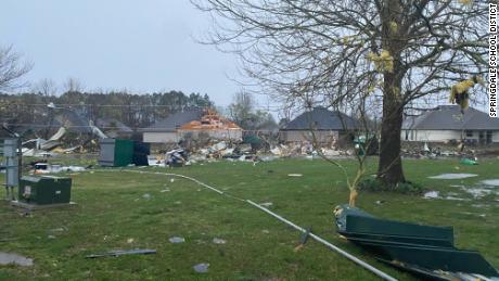
“Many residents have been displaced from their homes and numerous businesses have reported significant damages,” he said. There have been no reported deaths, he noted.
The Storm Prediction Center issued a tornado watch for Wednesday from 5:25 a.m. to 1 p.m. CDT covering parts of Arkansas, Louisiana, Missouri, Oklahoma and Texas.

The latter tornado watch contains the highest likelihood of multiple tornadoes, with the Storm Prediction Center giving a 90% chance of tornadoes occurring within the area. In addition to tornadoes, “damaging wind gusts are expected to result in widespread wind damage,” the SPC said, with gusts potentially reaching up to 80 mph.
Risks of severe storms throughout the day
As the storms move across Arkansas, the risk for severe storms will increase throughout the day.
“There is an increased threat of EF-2 to EF-5 tornadoes and severe thunderstorm wind gusts of 65 knots (75 mph) or greater,” the Weather Prediction Center said Wednesday morning.
By midday, changes in the atmospheric conditions near the line of storms will lead to “a rapid increase in storm coverage and intensity,” the Storm Prediction Center said.
A moderate risk –– level 4 of 5 — for severe storms covers the entire state of Mississippi and includes portions of Arkansas, Louisiana, Alabama and Tennessee. So, in addition to Jackson, populated cities like Memphis in Tennessee, Baton Rouge in Louisiana and Mobile and Montgomery in Alabama are all in this risk category.
The bulk of the most vigorous activity is expected to become severe as it quickly crosses the Mississippi River into Mississippi, western Tennessee and Kentucky, the SPC said.
“We are expecting a long duration severe weather event today with damaging winds even before the storms arrive and destructive winds during the main event,” Logan Poole, a meteorologist with the NWS in Jackson, told CNN.
All across the South, winds are forecast to be strong ahead of the main line of storms which will have even stronger winds. Even before the storms approach, there could be damaging wind gusts of nearly 60 mph out of the south.
High wind warnings are in effect ahead of the line of storms stretching from northwestern Tennessee to the Louisiana Gulf Coast.
“This will certainly be widespread and likely to affect a larger portion of our population,” the NWS in Jackson wrote. “Winds up to 80 mph, in addition to the gradient wind ahead of the line, will pose risks of downed trees and powerlines and result in power outages.
The storm threat will continue through the evening hours and overnight, with storms hitting places like New Orleans, which is at a severe risk level 3 of 5, just about sunset.
As the storms make their way east across Alabama and the Florida Panhandle, they will begin to lose some of their potency before reaching places like Atlanta in the early morning hours.
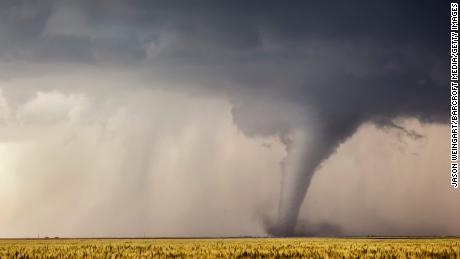
A near-record March for tornadoes
As of Wednesday morning, the SPC has tallied at least 187 preliminary reports of tornadoes in March. This is more than 233% of normal and just four shy of the highest March tornado count in recorded history (191 in March 2021), according to CNN meteorologist Pedram Javaheri.
On average, March averages about 80 tornadoes across the country.
Though the March record may be broken in a few hours with Wednesday’s storms, another tornado record has been standing far longer. The nat`ion is currently in the midst of its longest stretch without an EF-5 tornado, says Javaheri. “You would have to go back nearly a decade to May 20, 2013, for the last EF-5 in the country.”
Since that time, at least 11,322 tornadoes have touched down in the US, without a single one reaching the EF-5 threshold (200+ mph).
“This is a streak we’ll hope to continue today.”
CNN’s Laura James, Brandon Miller contributed to this report.