Ice accumulations expected in mountains, some concerns in northern Upstate counties
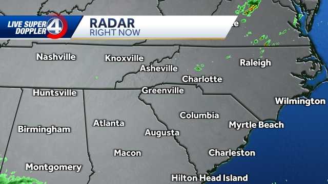
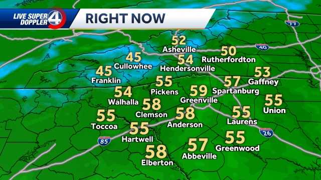
Well, good morning. We continue to see an active weather pattern across the mountains and across the upstate as well, with some sleet and freezing rain already beginning in the mountains very early this morning. So light ice accumulation already beginning to form there, we’ve got heavy, cold rain across the upstate with icy spots possible north and east of I 85. Watching areas like Gaffney, Spartanburg, northern Greenville County. You could see most of the mountains still under a winter storm. Warning. This goes into effect until seven o’clock tonight. We’ve also got parts of the upstate under a winter weather advisory also in effect until seven o’clock tonight. So any of these areas in purple could see some freezing rain, mixing in with rain at times and causing some slick spots on top of that new overnight. We’ve got flash flood watches in effect for portions of northeastern Georgia and extreme south and eastern parts of South Carolina. Flash flood watch means, of course, we’re gonna get a lot of rain in a short amount of time. Most of that will be to the south and east of us that really heavy rain. But we’re gonna get some heavy rain as we go throughout the next several hours. Here. Here’s the latest on the ice impacts or possible ice impacts. You could see a quarter to half an inch of ice expected in higher elevations. Ah, and right around the I 40 corridor, maybe a little bit less than that as you move to the south. But I will say when you’re talking about a quarter of an inch or higher, you are looking at some spotty power outages in the upstate. We could still see some slick spots. Still, some of our weather models picking up on that possibility, possibly as far south as northern Greenville. We will see, but it is certainly possible. So, at the very least, is you head out in about today. Just make sure you take your time, especially on bridges and overpasses. Uh, any elevated areas will be most likely to freeze. First, you could see quite a bit of rainfall across the area to our south. Once again, we’ve got some severe weather and portions of southern Georgia and even in the Panhandle of Florida. This happened yesterday. It’s happening again. Right now, we’re seeing lots of pink lots of freezing rain and sleet across the mountains in very high elevation. Some of that trying to change over to snow as temperatures already freezing across the mountains this morning, you could see across the upstate, though. We’re looking at a cold rain. So this is kind of the first round as we take a look at four o’clock this morning. But we’re gonna be getting several more rounds as we go throughout the day here. Seven o’clock, Uh, eight o’clock. Notice. We’re still picking up on some freezing rain across parts of the area. And then again, for most of the upstate, it really is just going to be a cold rain. But again, in those areas where we have an advisory, we could have some freezing rain mixing in with rain, at times causing some slick spots. And because it’s happening right before and during our morning commute, we just wanna make sure that you know to drive a little bit more carefully in the mountains. Definitely ice accumulation notices we go into this afternoon. We’ll start to see things taper down. We might see an isolated thunderstorm or too close to Greenwood Abbeyville, possibly Lawrence, but that has yet to be seen. We just could see a heavy downpours of some thunder and lightning there as we go into tomorrow morning. Just some light snowfall on the Tennessee North Carolina line. But that’s it. In fact, by the time tomorrow rolls around, it’s gonna be much, much better out there. So as we go throughout the day this morning, we’ll continue to watch all of these areas very carefully. Just wanted to kind of give you an early heads up, as’s to what could be happening here. Definitely a cold rain for most of us. Then tomorrow clearing skies. And then here you see on Saturday and Sunday. We’re looking at a pretty nice couple of days ahead. Next best chance of rain is Monday, but look at the middle part of next week. Some of us will be etching close to 70 degrees across the upstate, close to 60 in the mountains
Ice accumulations expected in mountains, some concerns in northern Upstate counties
Freezing rain has begun in parts of our area and temperatures are starting to drop. Significant ice accumulation is expected in the North Carolina mountains and there are some concerns for ice accumulation in the northern parts of the Upstate.(Specific timing in the video above) Drivers should treat bridges and overpasses as they are covered in ice even if it looks like rain.Power outages are also a concern across the area.LATEST ON CLOSINGS/DELAYS HERE A winter storm warning continues through 7 p.m. Thursday.More weather resources: Latest warnings, watches | Interactive radar | Extended forecast A winter weather advisory covers most of the northern Upstate, including all counties north of the Interstate 85 corridor. The latest projections are edging closer to half an inch to an inch of ice for some in the mountains and a tenth to a half-inch in the northern Upstate. Friday will feature clearing skies with temperatures topping out near 50 degrees.
Freezing rain has begun in parts of our area and temperatures are starting to drop.
Significant ice accumulation is expected in the North Carolina mountains and there are some concerns for ice accumulation in the northern parts of the Upstate.
(Specific timing in the video above)
Drivers should treat bridges and overpasses as they are covered in ice even if it looks like rain.
Power outages are also a concern across the area.
LATEST ON CLOSINGS/DELAYS HERE
A winter storm warning continues through 7 p.m. Thursday.
More weather resources: Latest warnings, watches | Interactive radar | Extended forecast
A winter weather advisory covers most of the northern Upstate, including all counties north of the Interstate 85 corridor.
The latest projections are edging closer to half an inch to an inch of ice for some in the mountains and a tenth to a half-inch in the northern Upstate.
Friday will feature clearing skies with temperatures topping out near 50 degrees.


