ORLANDO, Fla. — Ian’s winds strengthened to 75 mph Thursday afternoon, meaning the storm is once again a hurricane.
This is a breaking news update. A previous version of this report is below.
Hurricane Ian made landfall in Florida on Wednesday as a strong Category 4 hurricane, bringing with it the threat of high winds, dangerous storm surges and even tornadoes.
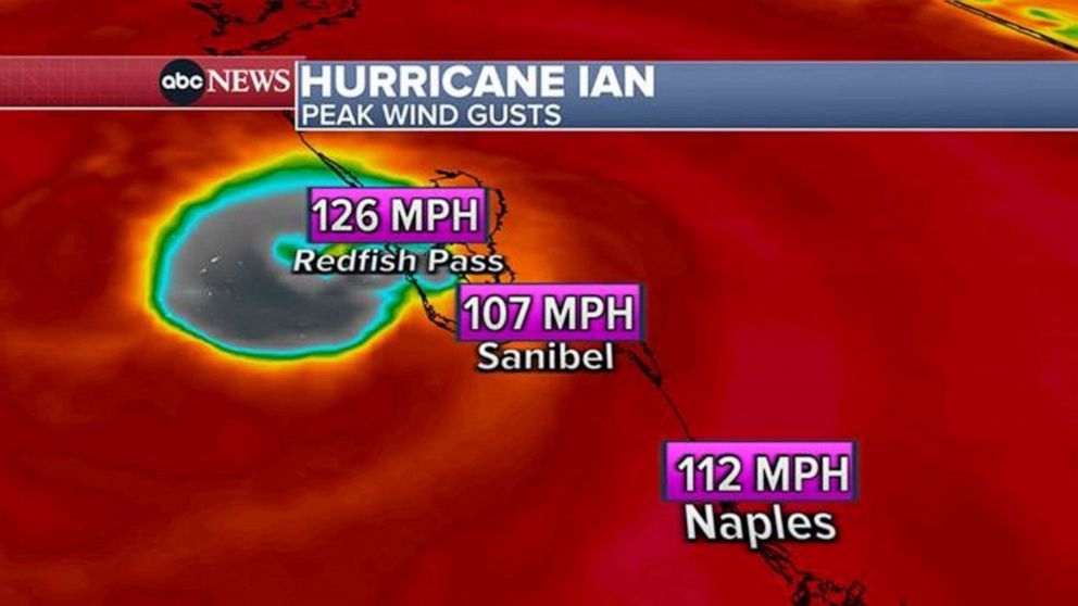
After traveling north through the Gulf of Mexico, Hurricane Ian made landfall along the southwestern coast of Florida around 3:05 p.m. ET as a Category 4 storm, with sustained winds near 150 mph, the National Hurricane Center said.
Landfall was near Cayo Costa, an island off the coast of Fort Myers. The storm was approaching Category 5 strength as it headed toward the coast.
Projected path and spaghetti model

The storm has since been downgraded to a tropical storm, with winds of 70 mph midday Thursday. It’s near Florida’s east coast and is moving back over water near Kennedy Space Center.
Ian is expected to re-intensify over the Atlantic and become at least a Category 1 hurricane as it approaches the South Carolina coast near Charleston Friday morning. Landfall is expected around noon.
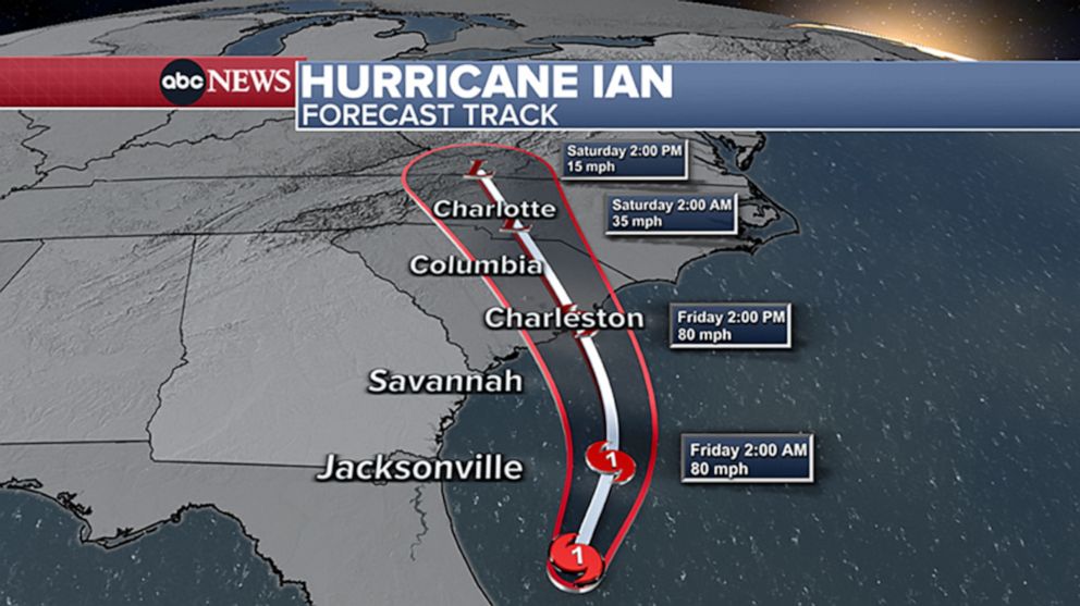
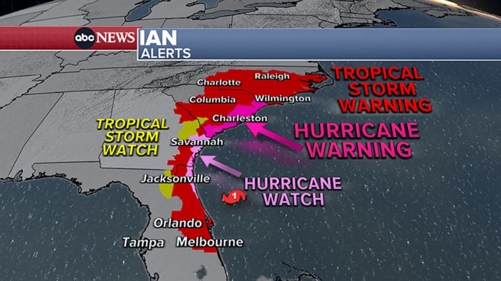
Weather alerts now extend across four states, from Florida to North Carolina. A hurricane warning has been issued for the entire coast of South Carolina and a tropical storm warning has been issued for North Carolina.
Storm surges
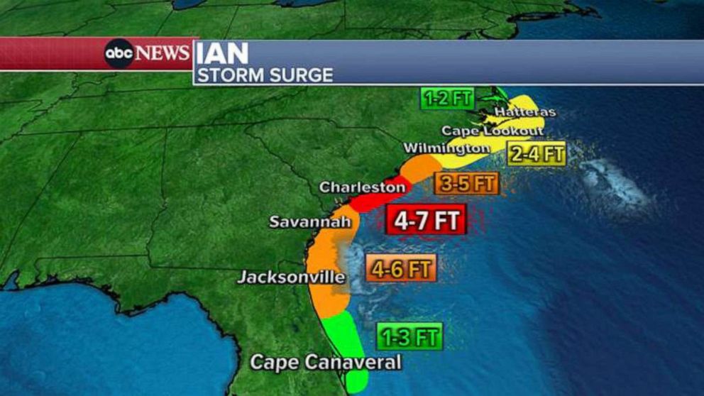
Parts of Florida have reported record storm surge, and life-threatening storm surge remains a risk as Ian moves north. Charleston, South Carolina, could see storm surge at least 7 feet high.
Rainfall
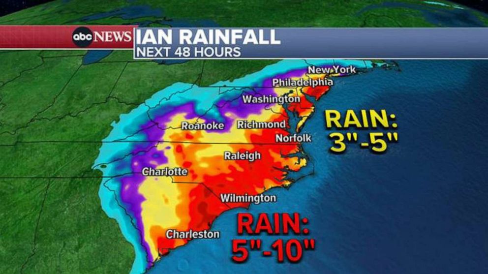
A large swath of the Florida Peninsula and up along the coast to South Carolina is forecast to get more than half a foot of rain through the upcoming weekend. Up to 10 inches is forecast from Charleston to the North Carolina border.
Up to 6 inches is also possible in parts of North Carolina and southern New Jersey.
Some of the heavy rain will come up to Philadelphia and New York City area by Saturday morning, with 2 to 3 inches of rain possible locally.
Extreme wind
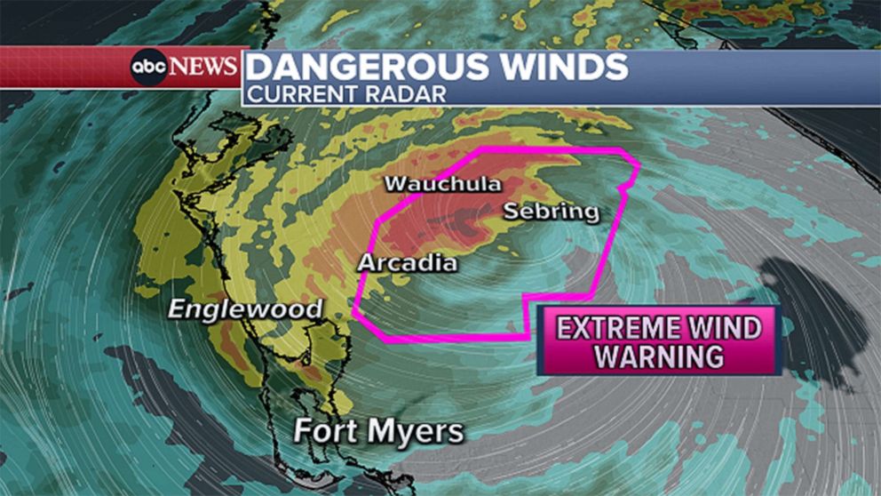
Sustained winds could exceed 115 mph in some parts. As Ian moves north, tropical storm force winds could reach coastal Georgia and South Carolina. Tropical storm watches have been issued for Savannah and near Charleston.
Tornado watch
Tornadoes are possible as Ian moves north through Florida. At least three were reported in south Florida Tuesday night as the storm approached. A tornado watch remained in effect for east-central Florida Wednesday evening.
ABC Owned TV Stations contributed to this report.
Copyright © 2022 ABC News Internet Ventures.