POLLOCK PINES, El Dorado County — Hoping to take advantage of calm winds, firefighters worked to slow the Caldor Fire’s spread on its east and west fronts Saturday afternoon, and protect communities near both Jenkinson Reservoir and Lake Tahoe.
The massive wildfire grew overnight by more than 4,000 acres and remained 19% contained as of Saturday morning. The two-week-old blaze has now consumed 149,684 acres of El Dorado County, destroyed 650 structures and injured four people.
Caldor continues to burn in a wide swath between trans-Sierra highways 50 and 88, west of the South Lake Tahoe area. Highway 50, the main route between the Bay Area and South Lake Tahoe, remains closed between Sly Park Road and Meyers.
Warmer weather, aided by the lifting of an inversion layer, was causing fire activity to pick up earlier in the day than it had Friday, said Jason Hunter, a spokesman for the effort to contain Caldor.
Officials were pouring “a ton of resources” into structure protection in the area, Hunter said. Their goal was to shore up neighborhoods’ defenses ahead of an expected wind shift that could bring the flames north toward Pollock Pines.
On the east side of the fire closest to Lake Tahoe’s south shore, the fire was mainly burning about two miles south of Strawberry, pushing north and northeast, Hunter said. But a greater concern for firefighters was the flames spreading on the north side of Highway 50, a spot fire that Hunter estimated had doubled in size the past three days.
South Lake Tahoe Mayor Tamara Wallace says she hopes the area’s steeper terrain will help firefighters stop the flames from reaching the Tahoe Basin’s deep valley.
Tracy Barbutes/Special to The ChronicleThat arm of Caldor ran the most risk of approaching the Tahoe Basin, Hunter said. But both he and South Lake Tahoe Mayor Tamara Wallace hoped that the area’s steeper terrain — in which thick vegetation gives way to large rock formations — would help firefighters stop the flames from reaching the basin’s deep valley.
“There’s a lot of granite between where the fire is and where we are,” Wallace said. “It’s not impossible that the fire could get to us, but it is unlikely.”
“That’s what we call a natural fuel break,” Hunter said as firefighters protected Caldor’s flames from burning a cabin on the north side of Highway 50. Several pockets of flames burned around the cabin, licking at the base of pines and cedars nearby. The structure was undamaged.
Still, Wallace said local officials were preparing in case Caldor makes a run toward the city of about 22,000 people. Hoping to learn from mistakes made by officials in other counties where local governments failed to adequately warn residents of catastrophic wildfires in the past, Wallace said South Lake Tahoe was ready to issue widespread emergency alerts to get residents out of harm’s way.
“We may not be able to save our community, but we will be able to save our people,” Wallace said. “I’m certain of that.”
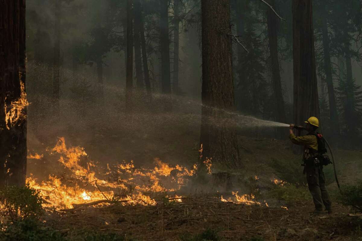
A firefighter sprays water on a tree that quickly caught fire during a back-burn operation near Kyburz (El Dorado County) during the Caldor Fire.
Tracy Barbutes/Special to The ChronicleOn the west side, south of Pollock Pines, firefighters sought to prevent the blaze from burning more toward the Sly Park and Somerset areas. Bright pink retardant blanketed many homes on the east side of Sly Park Road. In Pleasant Valley, firefighting helicopters routinely passed overhead.
Much of Highway 50 was shrouded in smoke so thick that little but the rough shapes of trees lining the road were visible. Flames burned slowly in isolated pockets on either side of the road.
Even for those not in evacuation zones, the environmental situation was dire — air quality readings were off the charts in downwind communities Saturday morning. In El Dorado Hills and Placerville, the Air Quality Index score — a basic yardstick for determining the level of air pollution — exceeded 500, which is the typical limit. Any score over 100 is considered unhealthy for all groups.
Outside of the South Lake Tahoe Recreation Center, the AQI was around 230.
At the tiny Lake Tahoe Airport, which also serves as the City Hall for South Lake Tahoe, the smoke was so thick late Friday afternoon that the shapes of the trees across from the airport’s single runway were barely visible from the main building on the other side.
Fred Page, a 62-year-old software company employee, spent 10 days at a vacation rental in South Lake Tahoe with his husband and their three dogs after evacuating from his home in Kyburz, southwest of the lake along Highway 50.
By Friday, the yellow-gray, smoke-filled skies had become too much for them to bear.
“We couldn’t really be outside, and with the dogs, they always want to be outside,” Page said in a phone interview after he had evacuated to a hotel in the East Bay. “My eyes are (still) red and itchy. It was more than unhealthy.”
At the Sierra-at-Tahoe ski resort, about 3 miles east of the fire’s edge, general manager John Rice said the choking, polluted air had cleared somewhat on Saturday morning but that smoke was still thick.
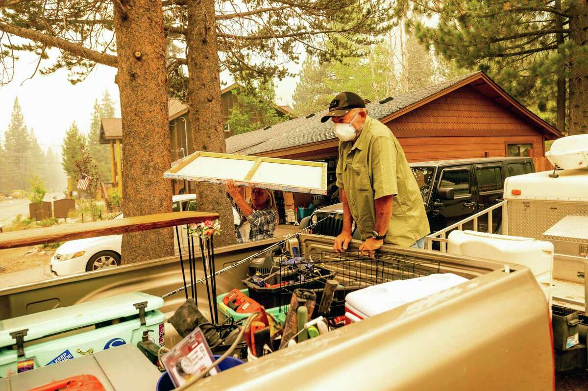
Bob Hansen and Patty Kingsbury evacuate from their South Lake Tahoe home Friday as the Caldor Fire approaches.
Noah Berger/Associated Press“Last night it was raining ash all night, almost like it was snowing,” he said. “The air quality was horrific. You couldn’t breathe.”
Rice spoke as he drove from the resort west on Highway 50, past small fires burning just off the roadway. He said he passed fire engines from seemingly every jurisdiction in California.
“Huntington Beach, Encinitas, Fresno, Merced, Sacramento, you name it,” he said. “You can see flames and spot fires everywhere. And there’s a lot of smoke.”
Rice said four of the resort’s artificial snow guns had been aimed at resort buildings in the event the flames drew closer.
Back in South Lake, Wallace said that any local resident with the means and desire to leave the area should do so, and that everyone who remains should stay inside as much as possible. To those who don’t live in the scenic town, the mayor’s message was far more blunt — don’t come, and if you’re already here, leave.
“That is a very difficult thing for me to say,” said Wallace, a former leader of the chamber of commerce. “But this is not the time to come to Lake Tahoe.”
In Pollock Pines, the Burger Barn was gearing up to serve free burgers and fries to first responders.
“It’s a blessing to help out,” said restaurant manager Breanna Aho. She added that the free burgers would be singles, not doubles, because “the firefighters have to go back out and we don’t want them to get too full.”
To the north, the Dixie Fire in Butte, Plumas and Shasta counties grew overight by about 4,000 acres, to 756,768 acres, with containment at 48% — an improvement of 1% from Friday night. An inversion layer slowed fire growth while limiting air operations, Cal Fire said in a statement.
“Humidity recovery was poor, allowing the fire to continue to burn actively throughout the night,” the Cal Fire statement said. “Isolated torching was observed with some spotting ahead of the fire.”
J.D. Morris, Steve Rubenstein and Danielle Echeverria are San Francisco Chronicle staff writers. Email: jd.morris@sfchronicle.com, srubenstein@sfchronicle.com, danielle.echeverria@sfchronicle.com; Twitter: @thejdmorris, @SteveRubeSF, @DanielleEchev