- Scientists Provide More Details On Recent Kilauea Magma Intrusion Big Island Video News
- Volcano Watch — Another intrusion southwest of Kīlauea’s summit | U.S. Geological Survey usgs.gov
- History’s best-monitored caldera-forming eruption provides insights into how earthquakes begin Stanford University
- Photo and Video Chronology – Aerial and ground surveys of Kīlauea, response instrumentation | U.S. Geological Survey usgs.gov
- Magma moving in Hawai‘i Volcanoes National Park slows, decreasing likelihood of Kīlauea eruption Big Island Now
Tag Archives: magma
Surprise magma chamber found under Mediterranean Sea volcano near popular tourist destination
A new study has uncovered a previously undetected magma chamber beneath Kolumbo, an active submarine volcano in the Mediterranean Sea near Santorini, Greece.
A group of international researchers used a novel imaging technique for volcanoes that produces high-resolution images of seismic wave properties, according to a Jan. 12 release from the American Geophysical Union (AGU).
The study was published in the AGU journal Geochemistry, Geophysics, Geosystems, and the authors noted that the presence of the chamber “poses a serious hazard as it could produce a highly explosive, tsunamigenic eruption in the near future.”
Researchers are recommending real-time hazard monitoring stations near other active submarine volcanoes to improve estimations of when an eruption might be likely to occur.
HUMPBACK WHALE WASHES UP ON MARYLAND SHORE
“The current state of the reservoir indicates that an explosive eruption of high societal impact in the future is possible (though not imminent), thus we suggest establishing a permanent observatory involving continuous earthquake monitoring… and seafloor geodesy,” they wrote.
The indicated eruption would be similar to but of a lesser magnitude to the recent Hunga Tonga-Hunga Ha’apai eruption, bringing a predicted tsunami and an eruptive column tens of kilometers high.
Maxar satellite imagery shows the Hunga Tonga-Hunga Ha’apai volcano on Dec. 24, 2021, before the eruption on Jan. 14, 2022, in the Hunga Tonga-Hunga Ha’apai Islands, Tonga.
(Maxar via Getty Images)
The study was reportedly the first to use full-waveform inversion seismic imaging to look for changes in magmatic activity beneath the surface of submarine volcanoes along the Hellenic Arc, where the volcano is located.
Submarine volcanic activity along a section of the Kolumbo crater on the seafloor, observed with SANTORY monitoring equipment.
(SANTORY)
The technology is applied to seismic profiles, or recordings of ground motions along kilometers-long lines, and assesses differences in wave velocities that may indicate subsurface anomalies. The group found that full-waveform inversion technology can be used in volcanic regions to find potential locations, sizes and melt rates of mobile magma bodies.
FLORIDA MANATEES STILL DYING OFF AT CONCERNING RATE, EXPERTS CAUTION
The seismic profiles were constructed after the scientists fired air-gun shots from aboard a research vessel cruising over the volcanic region, triggering seismic waves that were recorded by ocean-bottom seismometers located along the arc.
A significantly decreased velocity of seismic waves that travel beneath the seafloor indicated the presence of a mobile magma chamber underneath Kolumbo, according to the study, with the characteristics of the wave anomalies used to better understand the potential hazards the magma chamber may present.
Images helped to identify a large magma chamber that has been growing at an average rate of roughly 4 million cubic meters per year since Kolumbo’s last eruption in 1650 C.E., nearly 400 years ago.
A view of the town of Oia with its lime-washed houses and churches with blue domes on Santorini in the Aegean Sea.
(Marcos del Mazo / LightRocket via Getty Images / File)
The last time Kolumbo erupted, it killed 70 people in Santorini.
The study’s lead author noted that if the current rate of magma chamber growth continues, sometime in the next 150 years the volcano could reach the 2 cubic kilometers of melt volume that was estimated to be ejected during the 1650 C.E. eruption.
Although volcanic melt volumes can be estimated, there is no way to tell for sure when Kolumbo, which lies at around 500 meters deep, will erupt next.
CLICK HERE TO GET THE FOX NEWS APP
“We need better data on what’s actually beneath these volcanoes,” Kajetan Chrapkiewicz, a geophysicist at Imperial College London and the lead author of the study, said in a statement. “Continuous monitoring systems would allow us to have a better estimation of when an eruption might occur. With these systems, we would likely know about an eruption a few days before it happens, and people would be able to evacuate and stay safe.”
For the past few years, scientists have worked on establishing SANTORY (Santorini’s seafloor volcanic observatory) that will be able to measure progressions in Kolumbo’s volcanic activity. It is still under development.
Hidden Magma Chamber Reaching Critical Point ‘Poses Serious Threat’
A giant magma chamber has been discovered growing underneath an active submarine volcano in Greece.
Scientists, who have published a study on the chamber in the American Geophysical Union’s Geochemistry, Geophysics, and Geosystems, have determined that the magma chamber under Kolumbo increases the chances of a future eruption. They believe it could reach a critical point in the next 150 years and pose a “serious threat.”
Kolumbo last erupted in 1650 C.E. During this eruption, the explosion breached the sea surface and killed 70 people. This eruption occurred after magma reservoirs beneath the volcano continued to grow and accumulate at a large scale.
Scientists believe that this previously undiscovered magma chamber is growing at an average rate of roughly 4 million cubic meters per year since the submarine volcano last erupted. The amount of melt in there is now 1.4 cubic kilometers, the study reported.
Getty/solarseven
It is now reaching a similar volume that caused the 1650 eruption, meaning another large one may be around the corner as its rate of growth counteracts its cooling and crystallization processes.
Although scientists are not able to predict the exact time of the next Kolumbo eruption, they are now calling on better monitoring facilities near the volcano.
The magma chamber was discovered using full-waveform inversion technology, which records ground motions and analyzes wave velocities near volcanoes. Magma chambers can be detected by a reduced velocity of seismic waves traveling beneath the seafloor, the study reported.
Michele Paulatto, a volcanologist at Imperial College London, U.K., and second author of the study, said in a press release: “Full-waveform inversion is similar to a medical ultrasound. It uses sound waves to construct an image of the underground structure of a volcano.”
Nia Schamuells and Michele Paulatto
The study—prior to which detailed data was unavailable—helps inform scientists about submarine volcanoes in the region.
Kolumbo could potentially produce a highly explosive eruption. Scientists compare it to the recent eruption of Hunga Tonga, which last erupted in January 2022 and caused tsunami waves up to 66 feet high.
Scientists report that a Kolumbo eruption could be more destructive than the recent Tonga eruption due to its close proximity to Santorini—which is a well-known tourist destination. Popular hotspots on the island are only 4 miles from the volcano.
As the volcano is also in a shallow area of the sea, lying 1,600 feet below the surface of the ocean, this could make the explosion even bigger.
Underwater volcanoes like this have the potential to cause destructive tsunami waves as well as ashfall.
Although an explosion does not appear imminent, the findings of the study show scientists that the area needs increased monitoring.
“We need better data on what’s actually beneath these volcanoes,” Kajetan Chrapkiewicz, a geophysicist at Imperial College London and lead author of the study, said in a press release. “Continuous monitoring systems would allow us to have a better estimation of when an eruption might occur. With these systems, we would likely know about an eruption a few days before it happens, and people would be able to evacuate and stay safe.”
Do you have a tip on a science story that Newsweek should be covering? Do you have a question about volcanoes? Let us know via science@newsweek.com.
References
Chrapkiewicz at el, “Magma chamber detected beneath an arc volcano with full-waveform inversion of active-source seismic data”, Geochemistry, Geophysics and Geosystems, January 2023, 10.1029/2022GC010475
Hidden Magma Chamber Reaching Critical Point ‘Poses Serious Threat’
A giant magma chamber has been discovered growing underneath an active submarine volcano in Greece.
UP NEXT
Scientists, who have published a study on the chamber in the American Geophysical Union’s Geochemistry, Geophysics, and Geosystems, have determined that the magma chamber under Kolumbo increases the chances of a future eruption. They believe it could reach a critical point in the next 150 years and pose a “serious threat.”
Kolumbo last erupted in 1650 C.E. During this eruption, the explosion breached the sea surface and killed 70 people. This eruption occurred after magma reservoirs beneath the volcano continued to grow and accumulate at a large scale.
Scientists believe that this previously undiscovered magma chamber is growing at an average rate of roughly 4 million cubic meters per year since the submarine volcano last erupted. The amount of melt in there is now 1.4 cubic kilometers, the study reported.
It is now reaching a similar volume that caused the 1650 eruption, meaning another large one may be around the corner as its rate of growth counteracts its cooling and crystallization processes.
Although scientists are not able to predict the exact time of the next Kolumbo eruption, they are now calling on better monitoring facilities near the volcano.
The magma chamber was discovered using full-waveform inversion technology, which records ground motions and analyzes wave velocities near volcanoes. Magma chambers can be detected by a reduced velocity of seismic waves traveling beneath the seafloor, the study reported.
Michele Paulatto, a volcanologist at Imperial College London, U.K., and second author of the study, said in a press release: “Full-waveform inversion is similar to a medical ultrasound. It uses sound waves to construct an image of the underground structure of a volcano.”
© Nia Schamuells and Michele Paulatto
A graphic shows how the magma chamber, hiding under the volcano works. Although scientists are not able to predict the exact time of the next Kolumbo eruption, they are now calling on better monitoring facilities near the volcano. Nia Schamuells and Michele Paulatto
The study—prior to which detailed data was unavailable—helps inform scientists about submarine volcanoes in the region.
Kolumbo could potentially produce a highly explosive eruption. Scientists compare it to the recent eruption of Hunga Tonga, which last erupted in January 2022 and caused tsunami waves up to 66 feet high.
Scientists report that a Kolumbo eruption could be more destructive than the recent Tonga eruption due to its close proximity to Santorini—which is a well-known tourist destination. Popular hotspots on the island are only 4 miles from the volcano.
As the volcano is also in a shallow area of the sea, lying 1,600 feet below the surface of the ocean, this could make the explosion even bigger.
Underwater volcanoes like this have the potential to cause destructive tsunami waves as well as ashfall.
Although an explosion does not appear imminent, the findings of the study show scientists that the area needs increased monitoring.
“We need better data on what’s actually beneath these volcanoes,” Kajetan Chrapkiewicz, a geophysicist at Imperial College London and lead author of the study, said in a press release. “Continuous monitoring systems would allow us to have a better estimation of when an eruption might occur. With these systems, we would likely know about an eruption a few days before it happens, and people would be able to evacuate and stay safe.”
Do you have a tip on a science story that Newsweek should be covering? Do you have a question about volcanoes? Let us know via science@newsweek.com.
References
Chrapkiewicz at el, “Magma chamber detected beneath an arc volcano with full-waveform inversion of active-source seismic data”, Geochemistry, Geophysics and Geosystems, January 2023, 10.1029/2022GC010475
Related Articles
Start your unlimited Newsweek trial
Continue Reading
Hawaii volcanoes powered by ‘mind blowing’ magma network
Scientists had suspected that somewhere below Hawaii, a secret was entombed in stone — something that plays a leading role in influencing the island chain’s famous volcanism. Now, with the help of almost 200,000 earthquakes and a machine learning program, Wilding and his colleagues have finally unearthed it.
In a study published Thursday in the journal Science, the team has revealed a previously hidden collection of magma caches that may act like the beating heart of the volcanoes above. The discovery offers a possible solution to a long-standing mystery — how does magma from the deep mantle travel to the Hawaiian surface? The work gives scientists a valuable new window into the behavior of some of the most capricious, and hazardous, volcanoes on Earth.
The shallow magma reservoirs that feed Hawaii’s eruptions have been known about for some time. This is partly thanks to seismic waves, which are closely monitored in Hawaii by an ever-expanding network of sensors. The waves act like an ultrasound for Earth; changes in their speed and trajectory during their subterranean voyages tell scientists what sorts of matter they have been traveling through, providing clues to its temperature, density and composition.
But to truly understand what drives these volcanic powerhouses, scientists need to know what is happening at the interface of the squishy mantle and the solid crust. That is what the new study at last reveals in unexpected detail.
The giant feature described in the paper is made up of several elongated chambers named sills. When eruptions drain magma from the shallow reservoirs above, these deep-seated sills seem to react. A cacophony of quakes signals when individual chambers begin to fill with molten rock at different times, a bit like “blood rushing into a heart,” Wilding said.
“We were just looking at it, and it was just mind-blowing, it really was,” said Zachary Ross, a geophysicist at Caltech. “Ever since then, I can’t get the image of it out of my head.”
Ken Rubin, a volcanologist at the University of Hawaii not involved with the study, said, “It is a very elegant study, and an immensely intriguing result.”
Like much of the planet, Hawaii would not exist without volcanism. Since time immemorial, a deeply rooted fountain of superheated rock known as a mantle plume has been torching the underside of the Pacific tectonic plate. As the plate has continued to drift, a succession of epic volcanoes has risen above the waves, creating the Hawaiian island chain.
Today, the chain hosts a small family of active volcanoes, including the mercurial Mauna Loa and the hyperactive Kilauea on the Big Island, both of which stopped erupting simultaneously this month.
A persistent seismic rumble from an area southwest of Kilauea and 20 miles below ground had previously suggested that a collection of faults may exist there, creating pathways for magma to travel from the hadean depths to near-surface reservoirs. And since the 1980s, special kinds of quakes suggestive of roaming fluids have hinted that magma has been churning about in the region. But until recently, the true nature of this underground labyrinth was based more on speculation than scientific truth.
“It’s been this mysterious box in the mantle,” said Wilding. “We really have very little idea what’s going on.”
What scientists needed was a sustained spike in quakes coming from that exact region, enough to strongly illuminate that shadowy zone. Things looked promising in 2015 when the region’s rumbling picked up a little.
But the team’s lucky break came in 2018 when, after Kilauea had been erupting more or less continuously for 35 years, a grand finale-style eruption sequence began at the volcano. The event produced 320,000 Olympic-size swimming pools’ worth of lava in just three months — and the speedy exsanguination of the volcano’s shallow magma reservoir caused its summit to collapse dramatically.
In an exciting plot twist, geologists recorded a shocking spike in deep seismic activity in 2019 way below the town of Pāhala, which sits roughly 25 miles southwest of Kilauea. Surely, scientists thought, this cannot be happenstance.
While the Pāhala quake storm was a chance to unearth the island’s buried magmatic treasure, scientists alone would not be able to identify many of the individual quakes in that cacophony, especially the more commonplace smaller ones that could be smothered by bigger bangs.
Not willing to miss a single beat of the geologic drum, the team from Caltech fed the entire recording of the seismic storm to a machine learning program — a technique Ross and his colleagues had previously used to identify millions of hidden quakes in California. The program quickly taught itself what was a real quake and what was extraneous noise, then identified and characterized thousands of temblors that would have been missed by conventional seismic signal detection programs and their human analysts.
From November 2018 to April 2022, the system logged around 192,000 quakes below Pāhala. Plotting these luminiferous points on a map, the team was stunned to discover a collection of pulsing magmatic structures — the beating volcanic heart of southern Hawaii.
Some of the quakes came from a region 28 to 32 miles deep: these long-period earthquakes are usually attributed to the vibrations made by the movement of fluids, including magma. The bulk of the seismicity came from an area 22 to 27 miles deep. These volcano-tectonic quakes — the sort produced when a fault moves and rocks break inside a volcanic region — delineated a number of near-horizontal sheetlike structures, some of them four miles long and three miles wide.
At different times, the scientists detected surges in seismic activity within separate sheets. The team surmised that these sheets were sills, magma pockets whose own grumbles tracked molten rock rushing up from the lower fluid-filled region close to the mantle plume’s peak.
In search of a deeper connection
This new 3D map of a key segment of the Hawaiian circulatory system “is extraordinary,” said Jackie Caplan-Auerbach, a volcano seismologist at Western Washington University who wasn’t involved with the new study. It’s “awfully cool,” she said, that scientists cannot only see this previously hidden heart, but also can perceive the convulsions of the ventricles within.
The Pāhala Sill Complex, as the heart is technically known, appears to have several arteries branching from it. One major pathway, marked by rock-breaking quakes, appears to lead right into one of Kilauea’s shallow magma reservoirs. It’s perhaps no coincidence, then, that the sill complex began to thunder relentlessly in 2019. During the 2018 eruption, Kilauea was drained of a significant portion of its shallow magma supply, causing a pressure drop. In response, magma was sucked into the sills to equalize the pressure. Similar events happened during Kilauea’s briefer 2020 eruption.
Further work may help resolve the controversial question of whether Kilauea and Mauna Loa, which are relatively close neighbors at the surface, are somehow connected at great depths. To date, little concrete evidence for this hypothesis exists, and experts generally agree that the two volcanoes are largely independent of one another.
The new study does not overturn that consensus just yet. It shows another major artery of the sill complex, again marked by rock-breaking quakes, streaking up toward Mauna Loa. But this one stops short at a large horizontal fault and does not appear to reach one of Mauna Loa’s shallow magma reservoirs.
It also isn’t certain that magma is moving through either of these pathways. That would change if future work detects long-period quakes coming from them — the sort signifying the presence of fluids, likely to be magma.
“The results are stunning,” said Diana Roman, a geophysicist at the Carnegie Institution for Science in D.C. who wasn’t involved with the study. But “it is still unclear whether the magma being intruded at Pāhala directly feeds the eruptions of Mauna Loa and Kilauea.”
Roman also has studied the Pāhala quakes. Her co-written 2021 paper concluded they were the result of magma intruding at depth, causing simultaneous unrest at Mauna Loa and Kilauea by squeezing both of their underlying plumbing networks. The new study supports this notion of an indirect connection. But even with this mapped-out magmatic web, a more explicit link is too early to call.
Still, much of the Hawaiian underworld remains unexplored, and more magmatic arteries may yet be located, Ross said.
“What else is still in there that has not been lighting up?” he said. Whenever Hawaii’s hellish subsurface furiously shakes again, the team from Caltech will be ready to shine a spotlight on it, hoping to reveal what for now remains concealed.
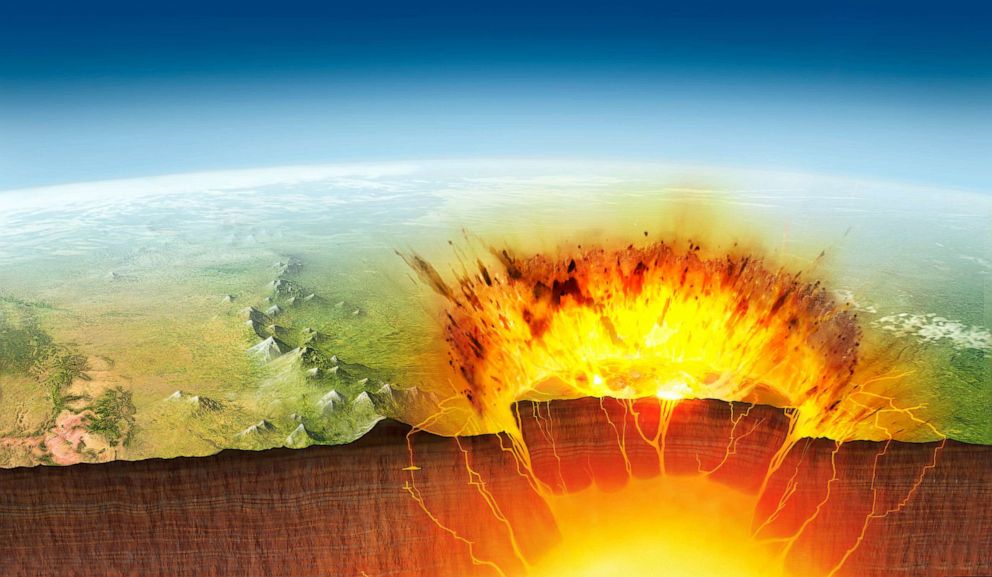
What Lies Beneath Yellowstone’s Volcano? Twice As Much Magma As Thought
The Yellowstone Caldera, sometimes referred to as the Yellowstone Supervolcano, is a volcanic caldera and supervolcano in Yellowstone National Park in the Western United States. The caldera measures 43 by 28 miles (70 by 45 kilometers).
Researcher’s expertise, energy, and empathy leave a legacy.
Late MSU researcher Min Chen contributed to new seismic tomography of the magma deposits underneath Yellowstone volcano.
When Ross Maguire was a postdoctoral researcher at Michigan State University (MSU), he wanted to study the volume and distribution of molten magma underneath the Yellowstone volcano. Maguire used a technique called seismic tomography, which uses ground vibrations known as seismic waves to create a 3D image of what is happening below Earth’s surface. Using this method, Maguire was able to create an image of the magma chamber framework showing where the magma was located. But these are not crystal-clear images.
As a result of these new images, with key contributions from Chen, Maguire and his team were able to see that, in fact, twice that amount of magma exists within Yellowstone’s magmatic system.
“I was looking for people who are experts in a particular type of computational-based seismic tomography called waveform tomography,” said Maguire, now an assistant professor at the University of Illinois Urbana-Champaign (UIUC). “Min Chen was really a world expert on this.”
Min Chen was an assistant professor at MSU in the Department of Computational Mathematics, Science and Engineering and the Department of Earth and Environmental Sciences in the College of Natural Science. Using the power of supercomputing, Chen developed the method applied to Maguire’s images to model more accurately how seismic waves propagate through the Earth. Chen’s creativity and skill brought those images into sharper focus, revealing more information about the amount of molten magma under Yellowstone’s volcano.
“We didn’t see an increase in the amount of magma,” Maguire said. “We just saw a clearer picture of what was already there.”


Min Chen. Credit: MSU
Previous images showed that Yellowstone’s volcano had a low concentration of magma — only 10% — surrounded by a solid crystalline framework. As a result of these new images, with key contributions from Chen, Maguire and his team were able to see that, in fact, twice that amount of magma exists within Yellowstone’s magmatic system.
“To be clear, the new discovery does not indicate a future eruption is likely to occur,” Maguire said. “Any signs of changes to the system would be captured by the network of geophysical instruments that continually monitors Yellowstone.”
Unfortunately, Chen never got to see the final results. Her unexpected death in 2021 continues to send shockwaves throughout the earth science community, which mourns the loss of her passion and expertise.
“Computational seismology is still relatively new at MSU,” said Songqiao “Shawn” Wei, an Endowed Assistant Professor of Geological Sciences in MSU’s Department of Earth and Environmental Sciences, who was a colleague of Chen’s. “Once the pandemic hit, Chen made her lectures and research discussions available on Zoom where researchers and students from all over the world could participate. That’s how a lot of seismologists worldwide got to know MSU.”
Her meetings were a place where gifted undergraduate students, postdoctoral candidates, or simply anyone who was interested were welcome to attend. Chen had prospective graduate students as well as seasoned seismologists from around the world join her virtual calls.
Chen cared deeply about her students’ well-being and careers. She fostered an inclusive and multidisciplinary environment in which she encouraged her students and postdoctoral candidates to become well-rounded scientists and to build long-term collaborations. She even held virtual seminars about life outside of academia to help students nurture their careers and hobbies. Chen led by example: She was an avid soccer player and knew how to dance the tango.
Diversity in science was another area about which Chen felt strongly. She advocated and championed research opportunities for women and underrepresented groups. To honor Chen, her colleagues created a memorial fellowship in her name to provide graduate student support for increasing diversity in computational and earth sciences. In another tribute to her life and love of gardening, Chen’s colleagues also planted a memorial tree in the square of the Engineering Building on MSU’s campus.
Chen was truly a leader in her field and was honored as a National Science Foundation Early CAREER Faculty Award recipient in 2020 to conduct detailed seismic imaging of North America to study Earth’s solid outer shell.
“She had so much energy,” Maguire said. “She focused on ensuring that people could be successful while she was incredibly successful.”
Maguire’s research, which showcases a portion of Chen’s legacy, is published in the journal Science.
References:
“Magma accumulation at depths of prior rhyolite storage beneath Yellowstone Caldera” by Ross Maguire, Brandon Schmandt, Jiaqi Li, Chengxin Jiang, Guoliang Li, Justin Wilgus and Min Chen, 1 December 2012, Science.
DOI: 10.1126/science.ade0347
“What lies beneath Yellowstone? There is more magma than previously recognized, but it may not be eruptible” by Kari M. Cooper, 1 December 2012, Science.
DOI: 10.1126/science.ade8435
Yellowstone supervolcano has a lot more magma than previously thought: Scientists
The supervolcano at Yellowstone National Park has substantially more magma reservoir under the caldera than scientists previously thought, according to new research.
In addition, the newly found lava is flowing at shallow depths that fueled prior eruptions, according to a paper published Thursday in Science.
Researchers mapped the seismic wave speed below the Yellowstone volcano using a technique called seismic tomography. This 3D modeling of seismic waveforms measures the volume of the melt and makes assumptions of the distribution of how the melt is spread in the subsurface in Yellowstone’s magma reservoir, Ross Maguire, an assistant professor at the University of Illinois Urbana-Champaign’s department of geology and author of the study, told ABC News.
“We found that it’s likely that Yellowstone’s crustal magma reservoir holds more melt than previously was thought,” Maguire said, adding that there is up to 20% melt at shallow depths.
Castle Geyser is a cone geyser in the Upper Geyser Basin of Yellowstone National Park.
George D. Lepp/Getty Images
Previous studies have suggested the partial melt fraction was between 5% and 15%, Maguire said.
The Yellowstone magma reservoir is not so much “a big tank of magma,” with accumulation all in one body, Maguire said, but rather, more like a “snow cone,” in which there is a solid component and a liquid component, Kari M. Cooper, professor and chair at the University of California Davis’s department of earth and planetary sciences, told ABC News.
The findings show it’s possible there are some relatively small to moderate-size bodies of magma that are below Yellowstone that could be mobilized and expelled, Cooper said. Yellowstone tends to garner a lot of attention because of the potential for “catastrophic, explosive eruptions,” Maguire said, but that’s not the most common type of eruption in the park.
“They would be of a similar size to what’s happened in the very recent Yellowstone history that’s produced a series of lava flows that filled the most recent caldera after the most recent really large eruption,” she said.

Yellowstone eruption, illustration. Yellowstone National Park is sited above an underground magma chamber.
/Science Photo Libra
Despite the new discovery, the research does not indicate that an eruption will happen any time soon, the scientists said. There are no signs of “increased volcanic unrest” at Yellowstone, Maguire said.
“This really does not change the hazard assessment at all, because we already knew that. We already knew this was the recent activity,” Cooper said. “We already knew that was the most likely sort of activity to happen next.”
However, a key issue for assessing the hazards of volcanic eruption is to ascertain how much magma is below the surface and where, and continued monitoring of the subsurface is important to provide a clear picture if the situation begins to dramatically change, the researchers said.

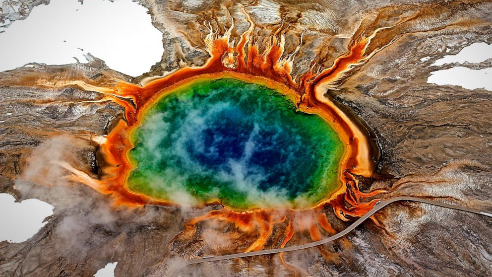
Grand Prismatic Spring In Yellowstone National Park.
Marie-louise Mandl/Eyeem/Getty Images
In addition, Yellowstone is thoroughly monitored by the U.S. Geological Survey and the Yellowstone Volcano Observatory, Cooper said.
Magma Beneath a Long-Dormant Volcano Has Been Observed Moving Upwards
Don’t worry, an eruption is not imminent.
Research reveals magma activity beneath Mount Edgecumbe.
According to a recent study from the Alaska Volcano Observatory, magma underneath the long-dormant Mount Edgecumbe volcano in Southeast Alaska has been moving upward through the Earth’s crust.
The observatory’s innovative method may enable early identification of volcanic activity in Alaska. According to computer modeling based on satellite data, magma at Mount Edgecumbe is rising from a depth of approximately 12 miles to around 6 miles, causing substantial surface deformation and earthquakes.
“That’s the fastest rate of volcanic deformation that we currently have in Alaska,” said the research paper’s lead author, Ronni Grapenthin, a University of Alaska Fairbanks associate professor of geodesy. “And while it is not uncommon for volcanoes to deform, the activity at Edgecumbe is unusual because reactivation of dormant volcanic systems is rarely observed,” he said.
According to Grapenthin, an eruption is not imminent. Researchers from the UAF Geophysical Institute and the U.S. Geological Survey recently published their findings in the journal Geophysical Research Letters.
The Alaska Volcano Observatory cooperated with another Geophysical Institute unit, the Alaska Satellite Facility, to analyze data in the cloud – a first for the volcano team. Instead of having to download and organize data, which may take weeks or months, researchers can use cloud computing, which uses distant servers to store data and provide computing services.
When a series of earthquakes were detected near Mount Edgecumbe on April 11, 2022, the research team got to work. The researchers analyzed ground deformation detected in satellite radar data over the past 7 1/2 years.
Four days later, on April 15, the team had a preliminary result: An intrusion of new magma was causing the earthquakes. A small number of earthquakes began under Edgecumbe in 2020, but the cause was ambiguous until the deformation results were produced.
Additional data processing confirmed the preliminary finding. The Alaska Volcano Observatory informed the public on April 22, less than two weeks after the latest batch of Edgecumbe earthquakes was reported.
“We’ve done these kinds of analyses before, but new streamlined cloud-based workflows cut weeks or months of analysis down to just days,” said David Fee, the Alaska Volcano Observatory’s coordinating scientist at the Geophysical Institute.
Mount Edgecumbe, at 3,200 feet, is on Kruzof Island on the west side of Sitka Sound. It is part of the Mount Edgecumbe Volcanic Field, which includes the domes and crater of adjacent Crater Ridge. Most striking for the researchers was an area of ground uplift on southern Kruzof Island 10.5 miles in diameter and centered 1.5 miles east of the volcano. The upward deformation began abruptly in August 2018 and continued at a rate of 3.4 inches annually, for a total of 10.6 inches through early 2022.
Subsequent computer modeling indicated the cause was the intrusion of new magma. The new deformation-based analysis will allow for earlier detection of volcanic unrest because ground deformation is one of its earliest indicators. Deformation can occur without accompanying seismic activity, making ground uplift a key symptom to watch.
The volcano observatory is applying the new approach to other volcanoes in Alaska, including Trident Volcano, about 30 miles north of Katmai Bay. The volcano is showing signs of elevated unrest. Mount Edgecumbe isn’t showing signs of an imminent eruption, Grapenthin said.
“This magma intrusion has been going on for three-plus years now,” he said. “Prior to an eruption, we expect more signs of unrest: more seismicity, more deformation, and — importantly — changes in the patterns of seismicity and deformation.”
The researchers say the magma is likely reaching an upper chamber through a near-vertical conduit. But they also believe the magma is precluded from moving further upward by thick magma already in the upper chamber.
The new magma is forcing the entire surface up instead. Mount Edgecumbe is 15 miles west of Sitka, which has a population of about 8,500 residents. The volcano last erupted 800 to 900 years ago, as cited in Lingít oral history handed down by Herman Kitka. A group of Tlingits in four canoes had camped on the coast about 15 or 20 miles south of some large smoke plumes, according to the account. A scouting party in a canoe was sent to investigate the smoke and reported: “a mountain blinking, spouting fire and smoke.”
Reference: “Return From Dormancy: Rapid Inflation and Seismic Unrest Driven by Transcrustal Magma Transfer at Mt. Edgecumbe (L’úx Shaa) Volcano, Alaska” by Ronni Grapenthin, Yitian Cheng, Mario Angarita, Darren Tan, Franz J. Meyer, David Fee and Aaron Wech, 10 October 2022, Geophysical Research Letters.
DOI: 10.1029/2022GL099464
The Alaska Volcano Observatory is a joint program of the Geophysical Institute, the U.S. Geological Survey, and the Alaska Division of Geological and Geophysical Surveys.
Jupiter’s Moon Io Might Have a Hellish Magma Ocean Beneath Its Surface
There are more than 200 moons in the solar system, but none quite like Io, the third largest of Jupiter’s 80 moons. Io is really, really volcanic. In fact, it’s peppered with so many hundreds of powerful active volcanoes that there must be something unusual beneath its crust.
That something could be a thick moonwide layer of molten rock—or a “subsurface magma ocean,” according to a new study published in the Planetary Science Journal on Nov. 16 from Yoshinori Miyazaki and David Stevenson, planetary scientists at the California Institute of Technology.
That possible super-hot sea of melted rock—which is unique in the solar system—could harbor secrets, weird mechanisms for forming moons and planets, and even recipes for exotic alien life. Only further scrutiny of the 2,200-mile-diameter moon will tell.
Miyazaki and Stevenson aren’t the first scientists to make an educated guess at what lies beneath Io’s potentially 20-mile-thick rocky crust. It’s been the subject of heated debate for years. But their new peer-reviewed study of the moon’s mantle might be the most thorough yet.
A volcanic explosion on Io, Jupiter’s third largest moon, as captured by NASA’s New Horizon spacecraft.
NASA/JPL/University of Arizona
To peer beneath Io’s surface, Miyazaki and Stevenson revisited reams of data from NASA’s Galileo probe, which orbited Jupiter for eight years starting in 1995. Initial analysis of the probe’s magnetic data led to a loose consensus that Io’s mantle—the layer under the moon’s crust—includes a 30-mile thick top layer that should be “molten or partially molten,” according to NASA.
Compare this to Earth’s own mantle, as well as the mantles of every other planetary body in the solar system, which are mostly solid and consist largely of ice or superheated rocks. Broadly speaking, planetary scientists reading the Galileo data assumed Io either has an underground magma ocean or a kind of sponge-like rocky outer mantle soaked in magma.
A fresh look at the data led Miyazaki and Stevenson concludes it’s the molten sea. They based their conclusion on estimates of the mantle’s temperature via analysis of Io’s volcanoes, which can spew magma hundreds of miles into the moon’s sulfur dioxide atmosphere. The top of the mantle might register as hot as 2,800 degrees Fahrenheit.
That’s hot. But not hot enough to sustain a spongy interior. The analysis is complicated, but it boils down to this: Like a pot of gravy on a stovetop, Io would need a lot of heat to stay consistently spongy in its upper mantle. Without enough heat, the gravy—er, the spongy rock—would separate: rock on bottom, magma on top.
Miyazaki and Stevenson crunched the numbers, calculating the heat from Io’s core as well as the effects of its weird, highly-elliptical orbit, which sloshes the mantle, spreads heat around, and keeps Io from ever permanently cooling.
They concluded that the gravy would separate. “The amount of internal heating is insufficient to maintain a high degree of melting,” they wrote. Hence what they believe could be a topmost magma ocean.
Luckily, we’ll know more soon. NASA’s Juno probe, which arrived around Jupiter in 2016, is scheduled to take readings of Io in 2023 and 2024—specifically measuring the “Love number,” a gauge of a planet’s rigidity or lack thereof. “If a large Love number is found, we can say with more certainty that a magma ocean exists beneath Io’s surface,” Miyazaki told The Daily Beast.
We already knew Io is weird. It’s possible it’s even weirder—and that weirdness could have implications across the space sciences. “I don’t think it greatly changes understanding of planetary formation, but it does change how we view the internal structure and thermal evolution of tidally heated bodies like Io,” David Grinspoon, a senior scientist with the Arizona-based Planetary Science Institute, told The Daily Beast.
Io and Europa, Jupiter’s two largest moons, captured by NASA’s Juno spacecraft.
NASA/JPL-Caltech/SwRI/MSSS/Roman Tkachenko
Lurking in the academic shadows are the astrobiologists. The experts in how and where life could evolve in the universe. If there’s extraterrestrial life out there somewhere and it looks like Earth life, we should expect to find it—or evidence of its extinction—on planets and moons that have, or had, Earthlike environments. Mars. Venus. A moon of Saturn called Enceladus.
But volcanoes with their extreme transfers of energy are widely considered key components of a living ecosystem. So planets and moons with lots of volcanoes are great places to look for E.T. In theory, that should include Io.
However, Io might have too many volcanoes. So if there’s life evolving there, it’s probably very strange life that really likes heat. “Lava tubes could be creating a condition favorable for microbes,” Miyazaki said.
The question, for astrobiologists, is whether a magma ocean would create more or fewer lava tubes than a magma sponge. “I don’t have an explicit answer,” Miyazaki said. “But it’s interesting to think about such implications.”
Dirk Schulze-Makuch, an astrobiologist at the Technical University Berlin, has long advocated a thorough search for life on Io. A magma ocean would only spoil that search if it were really close to the surface. A nice thick crust should insulate the outermost regions of the planet from scouring heat, and preserve the potential for evolution. “There seems to be quite a bit of crust,” Schulze-Makuch told The Daily Beast.
If anything, the possibility of a magma ocean on Io just underscores how interesting and exciting the moon is—and why it should be a top target for future space probes, Schulze-Makuch said. “Io is a unique kind of moon, very dynamic, and we should not dismiss it altogether.”
A Supervolcano in New Zealand Is Rumbling So Much It’s Shifting The Ground Above It
The vast expanse of Lake Taupō’s sky blue waters, crowned by hazy, mountainous horizons, invokes an extreme sense of tranquility.
And yet, deep in the ground below, geological unrest is brewing, according to a new paper in the New Zealand Journal of Geology and Geophysics.
Lake Taupō is the largest freshwater lake in Australasia, located at the center of New Zealand’s north island. And while it appears peaceful today, the lake has a violent origin story.
The lake’s waters sit within a prehistoric caldera – a word based on the Spanish for ‘cauldron’ or ‘boiling pot’ – formed during Earth’s most recent supereruption, the Oruanui eruption, 25,400 years ago.
When magma is released from a supervolcano (defined as having released at least 1,000 cubic kilometers of material in any one eruption) in an event like the Oruanui eruption, the depleted magma vents cave in, Earth’s surface sinks, and the landscape is permanently changed into a caldera.
In the last 12,000 years, the Taupō volcano has been active 25 times. Its most recent eruption in 232 AD is described by authors of the new paper as “one of the Earth’s most explosive eruptions in historic times”. Since then, the volcano has had at least four documented “episodes of unrest”, causing destructive earthquakes and, in 1922, a massive ground subsidence.
It’s the supervolcano’s more modern periods of unrest that the researchers have studied, analyzing up to 42 years of data collected at 22 sites dotted around and across the lake. And there’s evidence that the supervolcano is still rumbling.
“In 1979 [researchers] began a novel surveying technique which uses the lake surface to detect small changes, with four surveys made every year since,” lead author and Victoria University of Wellington seismologist Finn Illsley-Kemp explained. This technique involves the use of a gauge that measures vertical displacement of the lake bed.
To ensure the data are reliable, these gauges are weighted to reduce the impact of waves, and several measurements are taken for each datapoint, to detect degrees of variation and outliers. A backup gauge is also installed at each site as an insurance against disturbance by other forces.
In the project’s beginning, the measurements were recorded from manual gauges set up at just six stations. Eight more stations were added between August 1982 and July 1983, and during this time, the value of these measurements began to show.
In early 1983, the system detected rising or falling across different sites. Not long after, a swarm of earthquakes gently shook the region, resulting in the rupturing of several faults that pushed the central Kaiapo fault belt down and caused other areas at the lake’s south end to rise.
The 1983 earthquake swarms were only the first of seven discreet episodes of unrest recorded over the past 35 years.
By 1986 routine surveys were being carried out each year with additional sensors, with extra observations in the wake of earthquakes, creating a robust dataset that has only become more detailed over time.
The authors noticed that during periods of geological unrest, the north-eastern end of the lake (which is closest to the volcano’s center and the adjoining fault lines) tended to rise; the lake bed near the fault belt’s center sank; and at the lake’s southern end, there was some minor subsidence.
“Within the lake, near Horomatangi Reefs, the volcano has caused 160 mm [16 cm or 6.3 inches] of uplift, whereas north of the lake the tectonic faults have caused 140 mm [5.5 inches] of subsidence,” Illsley-Kemp said.
He thinks this region, which has very few earthquakes compared to the surrounding areas, is the location of Taupō ‘s magma reservoir, with deep rock that is too hot and molten for earthquakes to occur.
The researchers say the 16 cm of uplift – which, while not catastrophic, is definitely enough to cause some damage to buildings or pipes – is possibly due to magma moving closer to the surface during periods of unrest.
Illsley-Kemp said the research shows Taupō is an active and dynamic volcano, intimately connected with the surrounding tectonics.
The researchers think the northeastern end of the volcano – which has the youngest vents – is more likely to be affected by the expansion of hot magma, pushing the ground upwards. They think the ‘sinking’ center of the Taupō fault, and the subsidence at the lake’s southern end is likely due to deep magma cooling (and therefore shrinking), a tectonic extension of a rift, or both.
Illsley-Kemp has regularly assured people that while it’s in a state of unrest, there is no evidence the volcano will erupt anytime soon.
“However, Taupō will most likely erupt at some stage over the next few thousand years – and so it’s important that we monitor and understand these unrest periods so that we can quickly identify any signs which might indicate a forthcoming eruption,” he told the New Zealand Herald in a 2021 article.
Ultimately, this research is more about understanding the normal ‘behavior’ of the caldera, and what to look for when things are getting more heated.
This study is published in the New Zealand Journal of Geology and Geophysics and Geophysics.