Tag Archives: landslides

Another atmospheric river lashes California, renewing flooding concerns in state where storms have left at least 19 dead


CNN
 — 

Another atmospheric river has arrived in storm-battered California, bringing renewed flooding fears, possible landslides and treacherous travel to the state Monday where a relentless string of storms has already delivered widespread damage and left at least 19 dead in recent weeks.

“We have lost too much – too many people to these storms and in these waters,” Gov. Gavin Newsom said in a statement Saturday, urging residents to prepare for another round of rain.

The latest storm is set to bring heavy mountain snow and periods of heavy rain, with an additional 1 to 3 inches of rainfall expected in areas already too saturated to absorb more water.

Flood watches remain in place for around 8 million people in coastal California, including the Bay Area, until Monday afternoon. A slight risk – level 2 out of 4 – for excessive rain and flooding covers a large chunk of Southern California, including the Los Angeles metro area, until Monday morning then drops to a marginal risk through the day.

Meanwhile, winter storm warnings are posted for the Sierra Nevada where up to 3 feet of new snow could fall through Monday.

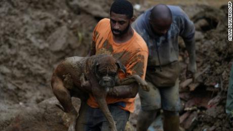
Residents of Ventura County’s remote Matilija Canyon were being urged Sunday to leave their homes after more than 17 inches of high-intensity rainfall resulted in significant damage and left towering piles of rock and mud over 40-feet tall blocking some roadways, isolating residents, the Ventura County Sheriff’s Office said, adding that more than ten helicopter flights have carried more than 70 residents from the area.

To the north in San Joaquin County, around 175 residents were voluntarily evacuated from a mobile home park Sunday, including by boat, after flood waters inundated the community, according to the San Joaquin County Sheriff’s Office.

Evacuation warnings were also in place Sunday evening for residents near the Carmel River in Monterey County, on California’s Central Coast. A warning was also in place for residents in Sacramento County’s Wilton area.

“People are fatigued about evacuation orders. People are fatigued by seeing those Caltrans turn signs saying ‘detour’ – they’re just fatigued generally,” Newsom said in a news conference Saturday.

The parade of atmospheric rivers – long, narrow regions in the atmosphere that can carry moisture thousands of miles – turned California communities into lakes, crippled highways and prompted thousands of evacuations.

The good news? A much-needed stretch of dry weather is on the way.

“As we push into the day on Tuesday we’re looking for quieter weather across much of the state with one fast moving additional system arriving for later Wednesday into early Thursday. After that, looking for a period of dry weather for much of the state finally as we head into late week, and pretty much through the weekend,” a National Weather Service spokesman said.

Monday will see the latest round of rain slowly come to an end from Northern California in the early afternoon hours to Southern California later in the day.

But for now, the state is bracing for more flooding, mudslides and rescues. Swift water resources and firefighters have been positioned statewide in preparation for Monday, which could see this round’s heaviest rainfall, state officials said.

Wind gusts reached hurricane-force Sunday across the higher elevations of Southern California, where around 14 million people were under wind advisories into Monday.

And as the latest storm approached, President Joe Biden on Saturday approved California’s request for a disaster declaration, freeing up federal aid to supplement recovery efforts in areas of the state affected by storms, flooding and mudslides since December 27.

The federal assistance can include grants for temporary housing and home repairs, loans to help cover property losses for uninsured homes, according to the White House.

Some isolated higher rain rates of 0.5 inches per hour could lead to a couple instances of flooding, especially given the very wet conditions as atmospheric rivers hammered the state in previous weeks.

Though this weekend’s rainfall totals will be lower than in previous storms, the threshold for flooding is much lower now because the ground is too saturated and conditions are ripe for mudslides and landslides.

There have been 402 landslides recorded statewide since December 30, according to the California Geological Survey.

Rainfall totals in recent weeks have been immense. Already, San Francisco has recorded one of its top 15 wettest winters on record. The Bay Area could see another 1-2 inches by Monday afternoon and the wettest peaks can see up to 3 inches.

To the south, the Los Angeles area saw several locations set daily rainfall records with 1 to 2 inches received Saturday. Southern California may still see isolated areas where heavy rainfall could reach up to a half an inch per hour in the heaviest storms.

Some areas of Santa Cruz County have seen more than 34 inches of rain since December 26, according to county recovery official. If this is to be confirmed by the weather service, it would land Santa Cruz in the top five wettest winters on record – with still a month left to the season.

“We’re getting flooding in our coastal streams, creeks, and rivers,” Santa Cruz County official David Reid said. “And we’re getting extensive landslides and mudslides and road failures in our mountainous areas.”

“There’s definitely a fatigue that happens with the continued storms – folks begin to fear that what we’re telling them isn’t true, but we have real concerns,” Reid added.

The need for residents to follow evacuation orders and adhere to roadway closures is real. Crews around the state have for weeks responded to rescues on flooded streets and inundated neighborhoods.

Storm-related deaths in recent weeks have included a woman whose body was found inside a vehicle that washed into a flooded vineyard, two people who were found with trees on top of their tents, a child who was killed when a redwood tree fell on a home, and several other fatalities.

And in San Luis Obispo County, rescuers are still searching for 5-year-old Kyle Doan, who was pulled from his mother’s hands by rushing floodwater on Monday after their SUV was swept away.

Rains on Saturday hampered the search as water levels rose in the San Marcos Creek and Salinas River, but crews were back out searching for the boy on Sunday as conditions improved, the San Luis Obispo County Sheriff’s Office said.

As lower elevations deal with heavy rainfall, and potential floods and mudslides, those living on higher elevations can expect heavy snowfall and dangerous conditions on the road.

Up to 3 feet of new snow could fall through Monday in Sierra Nevada while mountains in Southern California could see several inches of snow by early Tuesday morning.

Flagstaff, Arizona, saw 14.8 inches on Sunday, shattering a previous record of 8.9 inches set back in 1978.

“Heavy mountain snow and strong winds will lead to blowing snow and whiteout conditions at times, creating dangerous to near impossible travel above 4,000 ft in the mountains and passes of Central California and above 5,000 ft for Southern California,” the National Weather Service said.

Snow could hammer the mountains at a rate of 2 inches per hour at times into Monday morning in the Sierra Nevada, the weather service added.

For Tuesday, the rain and snow will move into the Four Corners Region, but isolated showers and snow showers could still impact parts of Southern California Tuesday morning.

Lower elevations in Arizona, Nevada, Utah and New Mexico can see 1-4 inches of snowfall and the higher elevations can see 1-2 feet.


Read original article here

More rain is on the way for storm-battered California, where storms have flooded communities and left 19 dead


CNN
 — 

Storm-battered California – still reeling from weeks of deadly flooding, mudslides and rescues – is being hit with more rainfall over the weekend.

An unrelenting string of atmospheric rivers – long, narrow regions in the atmosphere that can carry moisture thousands of miles – have turned communities into lakes, crippled highways and prompted thousands of evacuations, including earlier this week. At least 19 people have died as a result of the storms.

Two more are pummeling the state this weekend.

“This isn’t over; we must remain vigilant. Stay safe, make the necessary preparations, and limit non-essential travel,” Gov. Gavin Newsom said in a statement. “Floods, landslides, and storms don’t care who you are or where you live – it’ll hit you just the same. We have lost too much – too many people to these storms and in these waters.”

More than 8 million people were under flood watches Saturday night across much of California’s central coastline, as well as the Sacramento and San Joaquin Valleys.

A marginal risk of excessive rainfall is in place along the California coast from San Francisco down through San Diego, as well as the mountain ranges of southern California, where up to 2 inches of additional rainfall could lead to flooding and mudslides, the National Weather Service said.

Residents in Monterey County, on California’s Central Coast, were ordered to evacuate low-lying areas of the Carmel River Saturday afternoon. Sacramento County officials ordered residents of the Wilton area to flee – once again – due to an anticipated rise in the Cosumnes River.

“People are fatigued about evacuation orders. People are fatigued by seeing those Caltrans signs saying ‘detour’ – they’re just fatigued generally,” Newsom said, speaking from a flood evacuation shelter at the Merced County Fairgrounds.

President Joe Biden on Saturday approved California’s request for a disaster declaration, freeing up federal aid to supplement recovery efforts in areas of the state affected by storms, flooding and mudslides since December 27, the White House said.

“This federal aid is key to recovery efforts so Californians can get back on their feet faster,” Newsom said in a tweet thanking Biden for approving the declaration.

The first system of the weekend arrived at California’s coast Saturday afternoon and was expected to move inland, bringing heavy rain across the state “as another surge of Pacific moisture streams ahead of the main cold front,” the National Weather Service said.

Lighter rainfall is expected to continue Sunday morning, before another “ramp-up” late Sunday into early Monday ahead of a second system, the weather service said.

The new round of heavy rainfall comes after numerous areas already saw 50% to 70% of the amount of precipitation that they would usually get in a whole year in 16 days.

San Francisco has recorded one of its top 15 wettest winters on record.

Newsom said it was just weeks ago that authorities in Southern California extended a drought emergency to millions of residents. Now, the state is inundated with rain.

“By some estimates 22 to 25 trillion gallons of water have fallen over the course last 16-17 days – the stacking of these atmospheric rivers the likes of which we’ve not experienced in our lifetimes,” the governor said. “The reality is this is just the eighth of what we anticipate will be nine atmospheric rivers.”

Though this weekend’s rainfall totals will be less than in previous storms, the threshold for flooding is much lower now because the ground is too saturated to absorb any more water in many areas.

“The challenges will present themselves over the course of the next few days rather acutely, particularly because everything’s saturated, particularly because the grounds are overwhelmed.” Newsom said. “What may appear less significant in terms of the rainfall may actually be more significant in terms of the impacts on the ground and the flooding and the debris flow.”

Widespread rainfall totals through Monday will range between 2 to 3 inches along the coast and interior valleys, with 4 to 6 inches possible for the San Francisco Bay area and the nearby Santa Cruz and Santa Lucia mountains. This will likely lead to a few instances of flooding as well as mud, rock and landslides.

River flooding is also a major concern, particularly around the Russian River in Northern California and the Salinas River near Monterey.

Monterey County officials warned this week that flooding from the rising Salinas River could turn the area into an island and cut it off from essential services.

To the east, in Merced County, crews rushed to place rocks in the Bear Creek area ahead of the storm’s arrival, worried that high-water conditions could continue to erode the levee and eventually lead to levee failure in the downtown area of Merced.

Rescuers resumed their search for 5-year-old Kyle Doan, who was pulled from his mother’s hands by rushing floodwater on Monday, after it was hampered Saturday by the storm, the San Luis Obispo Sheriff’s Department said.

Water and weather conditions improved enough Sunday afternoon to allow the search to continue. Ongoing monitoring of the river, as well as the surrounding floodwater in San Miguel, have indicated a drop in water levels and will let the crew to search new areas, the sheriff’s department said.

The child and his mother were on the way to school Monday when floodwater overwhelmed their SUV. The mother managed to remove Kyle from his car seat and held onto him but their hands slipped and they were separated.

The mother was later pulled safely out of the water. But Kyle has not been found.

Members of the San Luis Obispo County Sheriff’s Office Dive Team, the Sheriff’s Search and Rescue Team, and California Highway Patrol air units were looking for the boy. Troops from the National Guard were previously involved with the search but have since been released from the mission.


Read original article here

‘A very significant emergency’: California’s deadly, record-setting storms are about to get an encore


CNN
 — 

The historic storms devastating much of California have turned entire neighborhoods into lakes, unleashed sewage into floodwater and killed at least 18 people.

And there’s more to come. About 5 million people were under flood watches Wednesday as yet another atmospheric river is bringing more rain to California.

“The state has been experiencing drought for the last four years, and now we have storm upon storm,” California Lt. Gov. Eleni Kounalakis said Wednesday.

“We’ve had six storms in the last two weeks. This is the kind of weather you would get in a year and we compressed it just into two weeks.”

It had already been “one of the deadliest disasters in the history of our state,” Brian Ferguson, California Governor’s Office of Emergency Services spokesman said Wednesday before the 18th death was reported.

“Yesterday, we had perhaps more air rescues than we’ve ever had on any other single day in the state’s history,” Ferguson said, adding that the Golden State is not out of the woods yet.

“While there is a bit of a break today, we continue to see additional storms prepared to come onshore in the next two days,” he said. “We’re continued to be concerned about our streams, our culverts and some of the areas that are prone to mudslides, particularly along our central coast.”

The flood watches Wednesday are primarily in Northern and Central California, including Sacramento, the North Bay and Redding. That barely leaves enough time for residents in flood-ravaged neighborhoods to assess the devastation before the next storm.

“It’s just brown water everywhere. And it’s just rushing through – it was going fast,” Fenton Grove resident Caitlin Clancy said.

“We had a canoe strapped up, that we thought if we needed to, we could canoe out. But it was moving too fast.”

The onslaught of recent storms came from a parade of atmospheric rivers – long, narrow regions in the atmosphere that can carry moisture thousands of miles.

“We have had five atmospheric rivers come into California over two weeks,” Kounalakis said.

“Everything is wet. Everything is saturated. Everything is at a breaking point, and there is more rain coming.”

In fact, four more atmospheric rivers are expected to hit California in the next 10 days.

Here’s what’s in store as another round of ferocious weather barrels down on the West Coast:

• The heaviest rain over the next seven days is expected in northern parts of California, where the National Weather Service predicts an additional 5 to 10 inches. On Wednesday, Northern California got a radar-estimated 1-2 inches of rain, with some higher elevations getting around 3 inches.

• The rain shifted north Wednesday afternoon, giving Central California a brief pause. There’s a slight risk – level 2 of 4 – for excessive rainfall Thursday for the northwest coast, and a marginal risk – level 1 of 4 – along the Pacific Northwest coast.

• Precipitation pushed inland to the Sierra Nevada Wednesday afternoon, dumping more snow. Snow was still falling Wednesday evening.

Another round of atmospheric moisture is expected to come onshore Friday, but less severe than earlier ones. A slight risk for excessive rainfall has been issued for the northwest coast of the state, with a marginal risk south, including the hard-hit Bay Area and San Luis Obispo.

Rescue crews in San Luis Obispo County are scrambling to find 5-year-old Kyle Doan, who was swept away from a truck near the Salinas River Monday morning.

National Guard members arrived Wednesday to help with the search, and more will be arriving Thursday, the San Luis Obispo County Sheriff’s Office said in a tweet Wednesday.

The sheriff’s office earlier urged the public to leave the search operation to the professionals to avoid the risk of volunteers needing to be rescued themselves.

As another storm looms, many residents are still grappling with devastation to their communities.

Rachel Oliviera used a shovel to try to push out some of the floodwater and thick mud enveloping her Felton Grove home.

“It’s backbreaking labor,” Oliviera said, visibly emotional.

But she was more concerned about her neighbors, whose homes were also covered in thick mud.

“A lot of us that live here in the neighborhood are elderly, and can’t actually physically do the cleanup.”

In the Los Angeles neighborhood of Chatsworth, several people had to be rescued after a sinkhole swallowed two vehicles Tuesday. In Malibu, a massive boulder came crashing down, shutting down a key roadway.

In parts of Santa Barbara County, “the storm caused flows through the sewer system to exceed capacity, resulting in the release of sewage from the system to the street,” County Supervising Environmental Health Specialist Jason Johnston said Monday evening.

The local health department warned the water could increase the risk of illnesses.

Another sinkhole was reported Monday in Santa Barbara County’s Santa Maria, where 20 homes were evacuated, CNN affiliate KEYT reported.

“The storms hit us like a water balloon exploding and just dropped water down through our rivers and creeks. So it’s been this excessive amount of flooding – it’s been the cycles over and over again,” Santa Cruz County spokesman Jason Hoppin told CNN.

Hoppin said 131 homes in the county received significant damage, but could be salvaged, while five others are not salvageable.

Trees have been toppling, claiming lives and causing property destruction and roadway obstructions. Sacramento officials estimate that about 1,000 trees have fallen since New Year’s Eve, Sacramento Department of Public Works spokeswoman Gabby Miller told CNN on Wednesday, adding that staff and crews have been working around the clock on cleanup.

In San Francisco, the public works department has logged about 1,300 tree-related incidents, which include downed trees, but also just limbs and branches, according to Rachel Gordon, director of policy and communications at San Francisco Public Works.

Parks that are home to some of the state’s iconic redwoods haven’t been spared, according to California State Parks spokesperson Adeline Yee.

“At Redwood National and State Parks and Big Basin Redwood State Park, we’ve seen some downed trees that are blocking roads and trails,” Yee said. “At this time, most of the trees that have come down are not the old-growth redwoods.”

In the state park system, 54 park units were closed as of Wednesday morning, and 38 were partially closed.

The recent atmospheric river storm system also has left dozens of state travel routes inoperable, and at least 40 are closed, according to Caltrans spokesman Will Arnold.

“Caltrans has activated our 12 Emergency Operations Centers throughout the state and more than 4,000 crews are running 24/7 maintenance patrols for road hazards like downed trees, flooded roads, mudslides/rockslides,” Arnold said.

The recent storms turned fatal after trees crashed onto homes and cars, rocks and mud cascaded down hillsides and floodwater rapidly rose.

At least 18 people have died in California storms in just the past two weeks. The latest victim was a 43-year-old woman, whose body was recovered Wednesday from inside a vehicle that had been washed into a flooded Sonoma County vineyard, officials said. Divers found the vehicle submergd in 8 to 10 feet of water.

“That’s more than we’ve lost in the last two years of wildfires,” the lieutenant governor said. “So this is a very significant emergency.”

Rebekah Rohde, 40, and Steven Sorensen, 61, were both found “with trees on top of their tents” over the weekend, the Sacramento County Coroner said. Both were unhoused, according to the release.

In the San Joaquin Valley, a tree fell on a pickup truck on State Route 99 in Visalia on Tuesday, killing the driver. A motorcyclist also died after crashing into the tree, the California Highway Patrol said.

Another driver died after entering a flooded roadway in Avila Beach Monday, the San Luis Obispo County Sheriff’s Office said.

“It only takes six inches of water to lose control of a car to be knocked over. In 12 inches, cars start floating away,” Kounalakis said this week.

“You’ve heard that creeks that have risen 14 feet just in the last day and in certain areas we’ve had over a foot of rain – just in the last 48 hours. So it is unbelievable.”

Several areas across the state have registered 50% to 70% of their average annual rainfall just since the parade of atmospheric river events began to impact the state on December 26, according to the National Weather Service. Oakland got 69% of its annual average, Santa Barbara 64%, Stockton 60%, and downtown San Francisco 59%.

Downtown San Francisco, Oakland and Santa Barbara have each gotten more than a foot of rain, according to the NWS.

Though none of the coming storms are expected to individually be as impactful as the most recent ones, the cumulative effect could be significant in a state where much of the soil is already too saturated to absorb any more rain.

And the state’s ongoing drought has parched the landscape so much, the soil struggles to absorb the incoming rainfall – which can lead to dangerous flash flooding.

Scientists have warned the climate crisis is having a significant effect on California’s weather, increasing the swings between extreme drought and extreme rain.


Read original article here

California storm: 90% of residents are under flood watches as another storm threatens mudslides, power outages and deadly inundation


CNN
 — 

Much of California can’t soak up another drop of rain. Yet the state is getting pummeled again with torrential downpours and ferocious winds, causing power outages and treacherous travel conditions.

More than 34 million Californians were under a flood watch Monday – about 90% of the state’s population and 10% of the US population.

Parts of the central California coast got walloped with 1 to 1.25 inches of rainfall per hour, the Weather Prediction Center said. Extensive rainfall there Monday triggered significant flooding, mudslides, debris flows and closed roadways.

Widespread rainfall totals of 3 to 6 inches have been observed from just south of San Francisco to just north of Los Angeles. Isolated amounts of 6 to more than 10 inches have been observed in the higher terrain near the coast.

As the rain shifted slowly to the south Monday toward Los Angeles, the National Weather Service there warned of the risk of flooding, debris flow in land scarred by recent wildfires and an increased risk of rock and mudslides in mountains and on canyon roads.

And hurricane-force wind gusts topping 74 mph thrashed states across the western US. More than 37 million people were under wind alerts Monday in California, Nevada, Oregon, Washington, Utah, Arizona and Wyoming.

A 132-mph wind gust lashed Oroville, California. Residents in Washoe City, Nevada, were hit with a 98-mph gust, the Weather Prediction Center said.

TRACK THE STORMS

“Expect widespread power outages, downed trees and difficult driving conditions,” the National Weather Service in Sacramento tweeted. “Now is the time to prepare if you have not already!”

Almost 92,000 homes, businesses and other power customers had no electricity Monday evening, according to PowerOutage.us.

And the central California coast could be at risk of a tornado, CNN Meteorologist Dave Hennen said.

The severe weather is part of a relentless parade of atmospheric rivers slamming the West Coast.

California is now extremely vulnerable to flooding because much of the state has been scarred by historic drought or devastating wildfires – meaning the land can’t soak up much rainfall.

And after an onslaught of storms since late December led to deadly flooding, Gov. Gavin Newsom warned Sunday: “We expect to see the worst of it still in front of us.”

Two bouts of major rainfall are expected to hammer the West Coast over the next few days – without much of a break between events for the water to recede.

The system is part of an atmospheric river – a long, narrow region in the atmosphere that can transport moisture thousands of miles, like a fire hose in the sky.

The atmospheric river slamming California on Monday could result in a 1-in-50 year or 1-in-100 year rainfall event near Fresno, the Weather Prediction Center said.

A moderate risk – level 3 of 4 – of excessive rainfall covers over 26 million people in California, including in San Francisco, Sacramento, Los Angeles and Fresno, where rain could fall at 1 inch per hour.

The San Lorenzo River in Santa Cruz County has risen 14 feet in just over four hours and is in major flood stage. Parts of the county will experience “widespread flooding at shallow depths,” and the city of Santa Cruz will have serious flooding, according to data from the National Oceanic and Atmospheric Administration and US Geological Survey.

The threat will shift further south Tuesday, with a level 3 of 4 risk centered over Los Angeles.

“While some of the forecast rain totals are impressive alone, it is important to note that what really sets this event apart are the antecedent conditions,” the National Weather Service office in San Francisco said.

“Multiple systems over the past week have saturated soil, increased flow in rivers and streams, and truly set the stage for this to become a high impact event.”

In Sacramento County, officials warned “flooding is imminent” and issued evacuation orders for the Wilton community near the Cosumnes River before roads become impassable.

Wilton residents also had to evacuate during last week’s storm, when exit routes flooded quickly, officials said.

El Dorado, Monterey, Santa Cruz and Santa Clara and Alameda counties have issued evacuation warnings or recommendations for some areas due to possible flooding and other safety risks as forecasters warned of swelling rivers.

Residents in all areas of Montecito, the city of Santa Barbara and parts of Carpinteria and Summerland are being ordered to evacuate immediately due to the threat of the ongoing storm, the Santa Barbara County Incident Management Team said on Monday evening.

“LEAVE NOW! This is a rapidly evolving situation,” the team said in a release.

Montecito is a haven for the rich and famous, including Prince Harry and his wife, Meghan, Duchess of Sussex; Oprah Winfrey and Ellen Degeneres. Monday marks exactly five years since heavy rains in the area caused deadly mud- and landslides.

Santa Barbara County authorities are advising residents to “be prepared to sustain yourself and your household for multiple days if you choose not to evacuate, as you may not be able to leave the area and emergency responders may not be able to access your property in the event of road damage, flooding, or a debris flow.”

Newsom on Sunday asked the White House for an emergency declaration to support response and recovery efforts.

“We are in the middle of a deadly barrage of winter storms – and California is using every resource at its disposal to protect lives and limit damage,” Newsom said in a statement. “We are taking the threat from these storms seriously, and want to make sure that Californians stay vigilant as more storms head our way.”

San Francisco Mayor London Breed on Monday issued a Local Proclamation of Emergency due to the ongoing series of winter storms that began New Year’s Eve, according to a news release from his office.

This storm system arrives on the heels of a powerful cyclone that flooded roads, toppled trees and knocked out power last week to much of California. Earlier, a New Year’s weekend storm system produced deadly flooding.

At least 12 Californians have died from “storm-related impacts” such as flooding since late December, the governor’s office said.

In San Luis Obispo County, dive teams from the sheriff’s office and Cal Fire rescuers were searching Monday for a 5-year-old child reported to have been swept away in flood waters near the Salinas River in San Miguel.

“Floods kill more individuals than any other natural disaster,” California Emergency Services Director Nancy Ward said Sunday. “We’ve already had more deaths in this flood storm since December 31 than we had in the last two fire seasons of the highest fire acreage burned in California.”

Flood-related deaths can happen when drivers attempt to cross standing water.

“Just a foot of water and your car’s floating. Half a foot of water, you’re off your feet. Half foot of water, you’re losing control of your vehicle,” Newsom said.

“We’re seeing people go around these detours because they don’t see any obstacles – they think everything is fine, and putting their lives at risk or putting first responders lives at risk.”

For anyone who doesn’t need to travel during the peak of this storm, “please don’t,” California Secretary of Natural Resources Wade Crowfoot said. “Be prepared for power outages and other interruptions. Have those flashlights, the candles, batteries, charge cell phones at the ready.”

Already, flooded roads, toppled trees and downed power lines are making travel difficult, California Highway Patrol said. Some fallen trees crushed cars and homes over the weekend. On Monday, portions of the Pacific Coast Highway – US 101, a major north-south highway, were closed.

The Santa Barbara Airport, a tri-county regional airport, is closed because of flooding airport officials said Monday.

California is experiencing “weather whiplash,” going from intense drought conditions to now contending with its fifth atmospheric river, Newsom said.

Much of the state has already seen 5 to 8 inches of rain over the last week. Two to 4 more inches of rain are expected across the coasts and valleys – and even more in mountains and foothills through Tuesday.

Rising from swelling rivers could spill over and inundate communities.

The rainfall over the weekend brought renewed flood concerns for streams, creeks and rivers. The Colgan Creek, Berryessa Creek, Mark West Creek, Green Valley Creek and the Cosumnes River all have gauges that are either above flood stage or expected to be in the next few days.

“The cumulative effect of successive heavy rainfall events will lead to additional instances of flooding. This includes rapid water rises, mudslides, and the potential for major river flooding,” the National Weather Service said Monday.

The moisture is expected to sink southward Monday night, making flooding “increasing likely” over the Southern California coastal ranges Tuesday, the weather service said. Fierce winds are expected to accompany the storm as it pushes inland.

“Valley areas will likely see gusts as high as 45-50 mph, with gusts greater than 60 mph possible in wind prone areas,” the National Weather Service in Reno said. The Sierra Ridge could receive peak gusts between 130 to 150 mph Monday.

For those at higher elevations, intense snow and ferocious winds will be the biggest concerns.

Parts of the higher elevations in the Sierra Nevada have gotten more than 100” – or 8.3 feet – of snow in just the past few weeks, the Weather Prediction Center said.

Now, another 6 feet of snow is expected in some parts of the Sierra.

As the storm pushes inland, more than 5 feet of snow could fall along the Sierra Crest west of Lake Tahoe, the weather service said.

The heavy snow and strong winds could lead to near whiteout conditions on roads.


Read original article here

2023 hits Northern California with flooding and landslides, and more could be on the way

Sacramento — Crews in Northern California were still scrambling early Monday to clean up the disastrous effects of record rainfall before another weather system moves in from the Pacific this week. A New Year’s storm brought deadly flooding, high winds and landslides, and a deep layer of heavy snow to some areas, shutting down freeways and stranding drivers.

The immediate concern on Monday morning around Sacramento was breached levees, several of which were threatening to flood more roadways.  

Many residents in Sacramento County were already under evacuation orders after the historic rains breached the levees, with authorities warning that the situation remained “incredibly dangerous.”


Massive storms batter California with heavy rain, wind and power outages

02:26

The fear is that swollen rivers could keep rising this week after they overflowed onto nearby roads. First responders rescued at least a dozen people stranded in vehicles over the weekend, with at least one person dying near the town of Wilton after trying to drive through high water.

Neighborhoods across Northern California have been submerged and landslides have blocked roads. Powerful wind gusts up to 60 miles per hour brought trees down on power lines, leaving tens of thousands of people in the dark.

A view of landslide on highway 92 West in San Mateo County, as heavy rains hit the West Coast of California, December 31, 2022.

Tayfun Coskun/Anadolu Agency/Getty


Further south in the San Francisco Bay Area, the iconic Fisherman’s Wharf experienced its wettest day in nearly 30 years, and the Oakland Zoo was set to be closed for at least two weeks after a huge sinkhole collapsed at its entrance.

The atmospheric river brought more than eight feet of snow to the Sierra Nevada mountains, shutting down roads and even closing many ski resorts.

As the system heads east through the Rockies, avalanche warnings were already in effect after one skier was killed near Breckenridge, Colorado, and another avalanche was caught on camera from downtown Telluride over the weekend.


First Alert Weather Day Monday for freezing rain and snow

03:37

There was one glimmer of hope brought by all the extreme weather in California, however: The storm system may have provided some desperately needed replenishment of drought-stricken reservoirs and mountain snowpacks.

But meteorologists said it was too early to determine whether this week’s storms will have any positive lasting impact.  

Read original article here

Italy landslide: Emergency declared on island of Ischia


CNN
 — 

Italy has declared a state of emergency after at least one person was killed as heavy rain caused a landslide on the Italian holiday island of Ischia on Saturday.

As of Sunday morning, 10 people remain missing, eight people have been rescued and 209 more evacuated from the area where the landslide occurred, the Campania Prefecture office told CNN.

Italian Prime Minister Giorgia Meloni announced the state of emergency over what she called “exceptional flood and landslide events” in a statement on Sunday.

It provides for €2 million ($2.082 million) in aid and assistance to the local population affected by the landslide, and came into effect from Saturday, adds the statement.

Search and rescue operations were underway in the small town of Casamicciola Terme and reinforcements were sent from Naples, said the Italian Fire Brigade, but weather conditions complicated the search, Italy’s Civil Protection department told CNN on Saturday.

The operations were being coordinated by the Naples prefecture, authorities told CNN. Seventy firefighters are currently on the island assisting with the search and rescue, Italian Fire Brigade said in a tweet.

Ischia, in the Gulf of Naples, was hit by torrential rain early Saturday, damaging cars, buildings and roads.

Videos and images shared by local and national authorities earlier today showed the destruction in the port town of Casamicciola Terme.

“It is a time of pain and great emergency,” Vincenzo De Luca, governor of the Campania region, where the island is located, said on Saturday, thanking Prime Minister Meloni for her close contact and message of solidarity.

Meloni said on Twitter that she was in contact with local authorities, expressing solidarity with residents and thanking the rescue services.

Ischia mayor Enzo Ferrandino described the incident as a “tragedy” and urged people not to leave their homes, reports ANSA news agency.

In February 2021 a landslide on the Italian coast near Genoa caused the collapse of a cemetery, leading to hundreds of coffins falling into the sea.

Read original article here

Venezuela landslide kills at least 25 people, 50 missing


CNN
 — 

A landslide in Venezuela on Sunday has killed at least 25 people and left more than 50 missing in the north central state of Aragua, according to officials.

The landslide came down in the Santos Michelena municipality after days of heavy rainfall caused the five streams of the Las Tejerías river to overflow, Venezuelan Vice President Delcy Rodríguez said.

Venezuela’s President Nicolás Maduro tweeted Sunday that he had ordered the “maximum deployment” of the interior ministry and security agencies to respond to the emergency.

More than 1,000 officials from the National Risk Management System and police officers are participating in the search and rescue operation, according to Carlos Pérez, Deputy Minister for Risk Management and Civil Protection.

The president also declared three days of national mourning starting Sunday, “in solidarity with the families affected,” according to his tweet.


Read original article here

Hurricane Fiona: Puerto Rico landfall


CNN
 — 

[Breaking news update at 3:52 p.m. ET]

Hurricane Fiona made landfall along the extreme southwestern coast of Puerto Rico near Punta Tocon at 3:20 p.m. ET with winds of 85 mph, according to the National Hurricane Center.

[Previous story, published at 3:09 p.m. ET]

Power has gone out across all of the US territory of Puerto Rico on Sunday, according to PowerOutage.us, as Hurricane Fiona bears down on the islands, which are already grappling with the threat of flooding and mudslides stemming from the Category 1 storm.

“Puerto Rico is 100% without power due to a transmission grid failure from Hurricane Fiona,” the website said.

Gov. Pedro Pierluisi confirmed the outage in a tweet, noting the entire electric system was out of service and officials have activated the proper protocols to work to restore power.

The blackout – which followed hours of progressively worsening power outages – comes five years after Puerto Rico’s power grid was devastated by Hurricane Maria in September 2017, leaving many residents without electricity for months. But officials have stressed it won’t be like last time: Not long before the lights went out, Abner Gomez, head of public safety and crisis management at LUMA Energy, which operates Puerto Rico’s power grid, said utility authorities plan to repair and restore electricity with the help of local government agencies.

“This is not Maria, this hurricane will not be Maria,” Gomez said.

Fiona has continued to strengthen Sunday and now packs sustained winds of 85 mph, according to the National Hurricane Center’s update at 2 p.m. ET, at which point the storm was about 25 miles southwest of the city of Ponce.

The storm’s impacts have already been felt: At least one death has been reported in Basse-Terre in the French territory of Guadeloupe, according to the vice president of the territory’s environmental agency, who said the capital had been devastated by flooding. And in Puerto Rico, flash flooding has already begun.

Pierluisi warned the storm “will cover our entire island” in a news conference Sunday, noting winds and rain bands from the storm may extend outward up to 100 to 120 miles. “This is impacting us now,” Pierluisi said. “It’s south of Puerto Rico but very close to our coast.”

The hurricane – the third of the 2022 Atlantic Hurricane Season – is bearing down on Puerto Rico, with the eyewall approaching the southern coast, according to the National Weather Service’s office in San Juan. Winds are expected to increase along the immediate coastline, the hurricane center said, while conditions are forecast to deteriorate throughout Sunday afternoon and evening as Fiona moves near or over the southwestern part of Puerto Rico.

There is a possibility Fiona’s center might skirt Puerto Rico, precluding a traditional “landfall.” But regardless, the impacts of the storm remain the same.

“Additional strengthening is forecast during the next 48 hours while Fiona moves near Puerto Rico, the Dominican Republic and over the southwestern Atlantic,” the hurricane center said. “Hurricane conditions are expected on Puerto Rico today, and are expected in portions of the eastern Dominican Republic tonight and Monday.”

The National Weather Service on Sunday warned of life-threatening to catastrophic flooding, issuing flash flood warnings for south and east Puerto Rico, including Ponce and Yabucoa, through at least mid-afternoon. The service said flooding had started after an estimated 1 to 4 inches of rain had already fallen.

Very heavy rainfall of 12 to 16 inches is forecast across a wide swath of Puerto Rico, with most of the rain expected Sunday, and isolated locations across southern and eastern Puerto Rico could see up to 25 inches, per the hurricane center.

The northern and eastern Dominican Republic, too, is forecast to see 4 to 8 inches of rain, with isolated totals up to 12 inches possible.

“These rains will produce life-threatening flash flooding and urban flooding across Puerto Rico and the eastern Dominican Republic, along with mudslides and landslides in areas of higher terrain,” the hurricane center said.

Already, authorities have responded to one such landslide: Emergency officials responded Saturday evening to a landslide around 8 p.m. ET at an apartment complex in Guaynabo, according to fire and public safety officials. There were no initial reports of injuries.

Puerto Rico officials continue to closely watch the island’s mountain regions, which have suffered landslides in the past and where the soil is saturated from the rain, Pierluisi said.

Around 120 shelters with 25,000 cots have been opened for those in need, the governor said. Classes Monday have been canceled and government workers – save emergency workers – should stay home, too.

A hurricane warning – indicating hurricane conditions are expected – was issued for Puerto Rico, including the islands of Vieques and Culebra, and later expanded to include the eastern Dominican Republic from Cabo Caucedo to Cabo Frances Viejo. The Dominican Republic’s northern coast, from Cabo Frances Viejo west to Puerto Plata, were under a hurricane watch Sunday morning, meaning hurricane conditions are possible in the next 48 hours.

How to prepare for a hurricane

President Joe Biden on Sunday morning approved an emergency declaration for Puerto Rico, freeing up federal resources, including the Federal Emergency Management Agency, for emergency response and disaster relief efforts.

The threat won’t end once the storm passes between Puerto Rico and the Dominican Republic. Further strengthening is expected, and the official forecast track indicates Fiona could be a major hurricane by Wednesday as it tracks to the east of the Bahamas and toward Bermuda.

“It appears likely that Fiona will become the first major hurricane of this Atlantic season in a few days,” the hurricane center said.


Read original article here

Southwest China quake leaves 30 dead, triggers landslides

BEIJING (AP) — At least 46 people were reported killed and 16 missing in a 6.8 magnitude earthquake that shook China’s southwestern province of Sichuan on Monday, triggering landslides and shaking buildings in the provincial capital of Chengdu, whose 21 million residents are already under a COVID-19 lockdown.

The quake struck a mountainous area in Luding county shortly after noon, the China Earthquake Networks Center said.

Sichuan, which sits on the edge of the Tibetan Plateau where tectonic plates meet, is regularly hit by earthquakes. Two quakes in June killed at least four people.

The death toll rose to 46 with 16 missing as the search for trapped people continued Monday night, state broadcaster CCTV said.

Earlier, authorities had reported 7 deaths in Luding county and 14 more in neighboring Shimian county to the south. Three of the dead were workers at the Hailuogou Scenic Area, a glacier and forest nature reserve.

Along with the deaths, authorities reported stones and soil falling from mountainsides, causing damage to homes and power interruptions, CCTV said. One landslide blocked a rural highway, leaving it strewn with rocks, the Ministry of Emergency Management said.

Buildings shook in Chengdu, 200 kilometers (125 miles) away from the epicenter. Resident Jiang Danli said she hid under a desk for five minutes in her 31st floor apartment. Many of her neighbors rushed downstairs, wary of aftershocks.

“There was a strong earthquake in June, but it wasn’t very scary. This time I was really scared, because I live on a high floor and the shaking made me dizzy,” she told The Associated Press.

The earthquake and lockdown follow a heat wave and drought that led to water shortages and power cuts due to Sichuan’s reliance on hydropower. That comes on top of the latest major lockdown under China’s strict “zero-COVID” policy.

The past two months in Chengdu “have been weird,” Jiang said.

The U.S. Geological Survey recorded a magnitude of 6.6 for Monday’s quake at a relatively shallow depth of 10 kilometers (6 miles). Preliminary measurements by different agencies often differ slightly.

China’s deadliest earthquake in recent years was a 7.9 magnitude quake in 2008 that killed nearly 90,000 people in Sichuan. The temblor devastated towns, schools and rural communities outside Chengdu, leading to a years-long effort to rebuild with more resistant materials.

Read original article here

Brazil: Heavy rains, landslides kill scores in mountain city

Another 134 people are missing, according to the Civil Defense of Rio, and officials say there is no official estimation for the total death toll, which keeps increasing as the rains continue.

Rainfall on Tuesday afternoon alone was more than the historical average for the whole of February, according to the Civil Defense of Rio.

Floodwaters raced through hillside neighborhoods, leaving a trail of destruction in their wake. Brazil’s Civil Defense Secretariat said on Tuesday that 269 landslides had been recorded, CNN affiliate CNN Brasil reported.

Search and rescue teams on Wednesday were wading through mud, scanning the wreckage for survivors. The National Civil Defense said it had saved 24 people, but that more than 439 people had lost their homes and rescue efforts were ongoing.

“The work continues and we will do the possible and the impossible to save lives,” Rio de Janeiro state governor, Claudio Castro, said Wednesday in a post on Twitter, where he’s been sharing updates.

Nestled in the hills north of the capital Rio de Janiero, Petropolis, nicknamed the “Imperial City” for its popularity among Brazil’s monarchy in the 19th century, is known for its palatial architecture, grand theaters and museums. On Wednesday, photos and footage showed swathes of the majestic city in ruins.

Brazil’s President Jair Bolsonaro, who was in Moscow meeting Russian President Vladimir Putin, said Wednesday that he had spoken to ministers and asked for “immediate assistance” to be sent to the victims.

Since the 1960s, southern Brazil has experienced an increase in both the number of extreme rain events and the mean amount of rainfall, according to the Intergovernmental Panel on Climate Change (IPCC).

This is partly explained by natural variability in weather patterns, but also because of climate change, as well as aerosols and the depletion of ozone in the atmosphere.

Average global temperatures are now at least 1.1 degrees Celsius higher than they were before industrialization. Warming of 2C would mean even more intense and frequent of extreme rain events and flooding in southern Brazil, according to the IPCC.

Scientists say the world needs to make deep, sustained cuts to greenhouse gases, primarily by transitioning away from fossil fuels, to contain global warming to 1.5C.

Brazil has seen a number of natural disasters in recent months.

At the beginning of February at least 24 people died after heavy rain battered São Paulo, home to Brazil’s financial center, triggering floods and landslides across the southeastern Brazilian state.

More than 1,546 families were displaced, according to a statement released by the State Civil Defense, which also said that at least eight children died in the disaster.

And at the end of December it was announced that the death toll from floods and heavy rain, which had blighted the Brazilian state of Bahia since November, had risen to 20.

Flooding also caused two dams to burst and the displacement of an estimated 62,800 people, state officials say.

Read original article here