CHICAGO (WLS) — Another winter storm has brought more snow to the Chicago area Thursday, with areas to the south and in Northwest Indiana particularly hard hit.
The day started with overnight heavy rain before there was a break for cloudy skies. Then icy snow moved into the area Thursday afternoon, accompanied by high winds that have hindered visibility and made driving conditions particularly perilous.
The National Weather Service has issued a Winter Storm Warning for eastern Will, Grundy, Kankakee, Livingston and southern Will counties in Illinois and Lake, Benton, Jasper and Newton counties in Indiana until 9 p.m. Thursday. The warning extends until 1 a.m. EST Friday in Porter County and until midnight EST in Elkhart, LaPorte, LaGrange, Marshall, St. Joseph and Starke counties.
A Winter Weather Advisory for northern Cook, DuPage, Kane, Kendall, LaSalle, northern Will, southern Cook and central Cook counties is in effect until 9 p.m. Thursday
While it took some time to stick, by 3:30 p.m. snow had begun accumulating on highways, creating slick and dangerous driving conditions. Spinouts and crashes were reported across the Chicago area. Authorities warned drivers to take it slow on the roads.
On I-65 in Indiana, north of the Lowell exit, whiteout conditions and snow accumulation have caused multiple crashes.
The snow, heavy at times, with gusty northeast winds is expected to last until about 9 p.m.
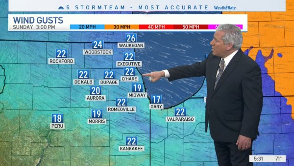
WATCH: Full ABC7 AccuWeather 7-day Forecast
Temperatures dropped to near freezing Wednesday night into Thursday, and the rain transitioned over to an icy mix from around 3 a.m. to about 10 a.m. Southern parts of the Chicago area could see some significant ice accumulation.
Click here to see school closings, moves to e-learning in the Chicago area
Early Thursday morning in the West Loop, a wintry mix was making the pavement slippery and wet, and over an inch of rain had fallen in some parts of the area, ABC7 meteorologist Tracy Butler said.
Drivers and pedestrians are urged to be cautious.
There was also some flooding near 31st Street and Cicero Avenue, where people starting pushing stalled cars through water above their knees.
Then, near a viaduct at 47th Street and the Dan Ryan, a few semitrailers were moving very slowly through high water.
WATCH: Cars struggle through high water on Far South Side
And at 52nd Street and Cicero, it’s unclear if inclement weather is to blame, but part of a brick wall on a building peeled away and crumbled to the ground, crashing onto some parked cars.
The most snow is expected to fall south of the city, with snowfall amounts ranging from 5 to 8 inches. In the city and points north, residents can expect closer to 1 to 3 inches.
Crews in Tinley Park said they are ready to go Thursday. Their salt supply is in good shape.
WATCH: Tinley Park, south suburbs prep for snow
A shipment arrived recently after a few rounds of heavy snow in the past few weeks depleted it.
The Tinley Park Public Works director said the village has 12 trucks loaded with salt. Those crews will work a 12-hour shift and then they will be backed up by 12 more trucks.
But they have been preparing since Wednesday.
“We prepped the streets. We had the crews go out with salt and get some salt down before the road iced up, and getting ready for the storm that’s supposed to hit us right around noon, as i understand it. And we have the trucks already loaded up, ready to go out on the streets and keep the citizens safe here in Tinley Park,” Tinley Park Public Works Director John Urbanski said.
The Thursday afternoon rush hour will likely be worse than the morning, Mowry said. With snow falling and winds gusting up to 35 mph, drivers should expect snow accumulation on the roads and poor visibility.
There were 211 Chicago Streets and Sanitation salt trucks deployed, focusing on main roads first. Street sweepers also cleared debris from underneath viaducts ahead of the heavy rain.
The Illinois Tollway is deploying its full fleet of 196 snowplows in response to freezing rain, sleet and snow expected to move into the area Thursday, possibly creating changing pavement conditions and scattered icy patches that could affect drivers during their morning and evening commutes.
“The biggest challenge that we’re going to have today is that a lot of the snow is going to be heart of the rush hour. So again, our trucks are going to be stuck in that rush hour just like everyone else, so that always tends to be more of a challenge. But again, please, you know, give them that route to work,” Illinois Department of Transportation spokeswoman Maria Castaneda said.
That ice could also impact rail travel, especially trains that rely on overhead wires, like the Metra Electric and South Shore lines. Metra said it would be running those trains overnight.
“Running up and down the lines to just make sure that there is no ice accumulating on those overhead wires,” Metra spokesman Michael Gillis said.
At O’Hare, over 200 flights had been canceled by noon, and over 100 were canceled at Midway.
With ice and heavy snow potentially snapping tree branches and knocking out power, ComEd is beefing up staffing.
“We’re also reaching out to contractors and other resources to make sure that we’ve got enough people on the system, so that if we start to see some impact from this weather, we’re ready to get on it right away,” ComEd spokesman John Schoen said.
Waves on Lake Michigan will build through the day Thursday, so areas along the lakeshore may experience some flooding as well.
There are numerous flood advisories, watches and warnings throughout the area, too.
Stay tuned to ABC7 Eyewitness News and ABC7Chicago.com for the latest updates on the winter storm.
Cook County Radar | DuPage County Radar | Will County Radar | Lake County Radar (IL) | Kane County Radar | Northwest Indiana Radar
Copyright © 2022 WLS-TV. All Rights Reserved.