Tag Archives: chicago snow

Chicago weather forecast: After several inches of snow accumulation from winter storm, deep freeze moves in across area

CHICAGO (WLS) — Bitterly cold temperatures have moved in Friday across the Chicago area following a winter snow storm.

Across the city and downtown Friday, people are bracing for the frigid temperatures, with some shoveling the snow that came Thursday night.

Wind chills Friday morning reached as low as -40 in some areas and air temperatures below zero. The cold is forecast to continue with wind chills staying well below zero through the day.

School Closings: See Full List

The snow moved in Thursday and punished the Chicago area into the evening hours. Now we are left with high winds and bitter cold.

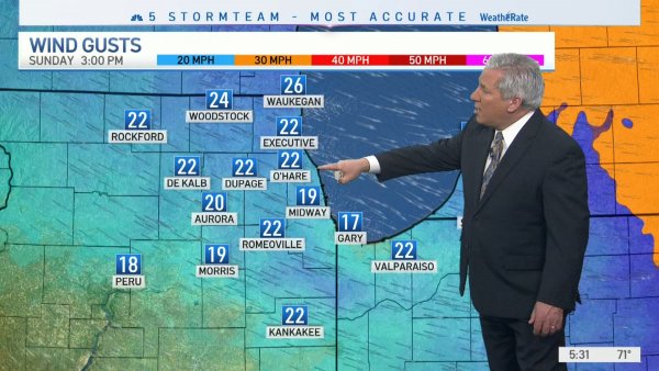
Hundreds of flight cancellations at O’Hare, Midway airports again Friday with brutal cold

Some suburbs saw several inches of snow accumulation Friday.

Snow Totals

Streator: 2.5 inches

Romeoville: 2.5 inches

Elmhurst: 2.3 inches

Peotone: 2.3 inches

St. Charles 2 inches

Downtown: 2 inches

The brutal cold comes with many dangers any skin that is visible to the air could get frostbite very quickly.

Latest 7-day Chicago weather forecast

The weather is still creating hazardous conditions on Chicago area roadways, with ice and blowing snow.

In northwest Indiana, Indiana State Police Sergeant Glen Fifield said lanes of I-65 were blocked over the I-94 overpass because trucks couldn’t get up over the incline. INDOT workers arrived with sand and trucks were then able to make it up the incline.

Fifield said roads there had very poor visibility with dozens of crash overnight.

Indiana State Police say crews will remain out on the roads through the evening hours to make sure drivers get to their destinations safely.

In the south suburbs, some drivers said the roads are actually pretty easy to drive on right because they’re so little traffic.

There are some icy spots along the way where people say they’re taking it slow, but for the most part those snow plows have cleared the way for drivers.

Mike Machi has been braving this entire storm in a trip from Boston to Milwaukee and things got a little dicey for him last night.

“I was gonna push through last night and I was like I can’t see,” Machi said. “The wind with the weather change I couldn’t see so I just parked it at a hotel for the night. I’ll finish the trip when I can see and it’s still bad out there with the wind.”

So drivers will continue to deal with those high winds throughout the day

Chicago warming centers available at 6 locations across city

IDOT spokesperson Maria Castaneda said while most of the snow has been cleared from expressways, the freezing temperatures reduce the effectiveness of road salt. Castaneda also said drivers should be worried about black ice on bridges and overpasses.

Metra is running a Saturday schedule on Friday. The cold temperatures has forced Metra to reduce top speeds for trains, causing some delays.

The winter weather is also creating problems at Chicago’s airports during the busy holiday travel season.

Meanwhile, in downtown Chicago, Tricia Sheridan headed home from an overnight nursing shift feeling every bit of the bitter weather.

“It just stings the eyes,” Sheridan said. “You feel like you immediately have icicles on your eyelashes. Burns the nose. Try to keep everything covered up.”

People in the Loop dressed in several layers, but it still doesn’t feel like enough.

Ronnie Knowles had to go out to get to work at Navy Pier, waiting for a warm CTA bus to arrive seems like an eternity.

“You have to be dressed for it because it’s definitely cold because I’m wearing layers to make sure that I’m warm enough to get where I’m going,” Knowles said.

The temperature on a bank sign along Wacker Drive read nine degrees below zero. Combine the gusty conditions with that arctic number and it amounts to feeling more like -30.

Eric Courtney says Chicagoans are made for this.

“It’s beautiful,” she said. “It’s Chicago. What more can I say?”

Meanwhile, while some are running last minute holiday errands, many are planning on staying inside until this cold snap passes.

“Home for the rest of the day,” Romeo Lee said. “Sit in the house and nothing else. I’m not even coming back out for today. Last night was enough for me.”

Heat Ordinance:

Chicago law requires residential buildings to have indoor temperature to be at least 68 degrees from 8:30 a.m. to 10:30 p.m.

The minimum is 66 degrees during the other hours. Landlords and building owners can face fines.

Call 311 to report inadequate heat. For more information, visit: www.chicago.gov/city/en/depts/bldgs/supp_info/chicago-heat-ordinance.html.

ComEd prepares for power outages

ComEd said it is in position to assist people quickly in the event of power outages.

ComEd customers can text OUT to 26633 (COMED) to report an outage and receive restoration information as well as following ComEd on Twitter or on Facebook. Customers can also call 1-800 EDISON1 (1-800-334-7661), or report outages via the website at ComEd.com/report or use the ComEd app.

Stay tuned to ABC7 Eyewitness News and ABC7Chicago.com for the latest forecast and snowfall amounts as the winter storm approaches.

Cook County Radar DuPage County Radar Will County Radar Lake County Radar (IL) Kane County Radar Northwest Indiana Radar

Copyright © 2022 WLS-TV. All Rights Reserved.

Read original article here

Chicago weather forecast calls for several inches of snow; Winter Storm Warning in Illinois today, Blizzard Warning in NW Indiana

CHICAGO (WLS) — A winter weather snow storm is moving into the Chicago area Thursday, with several inches of snow forecast along with high winds and dangerous wind chills.

The National Weather Service has issued a Winter Storm Warning for the entire Chicago area and northwest Indiana.

School Closings: See Full List

The warning is in effect from 9 a.m. Thursday until Saturday at 6 a.m. for DeKalb, Kane, Kendall, Grundy, Livingston and McHenry counties. For the rest of the Chicago area, the alert is in effect from noon Thursday until 6 a.m. Saturday, with the alert starting at 3 p.m. for areas in northwest Indiana.

WATCH | Latest 7-day Chicago weather forecast

ABC7 Chicago Meteorologist Tracy Butler said the storm could start moving into the western suburbs by 9 a.m., with the city seeing snow by noon and northwest Indiana by 3 p.m.

Butler said three to six inches of snow are expected from the storm, with higher amounts possible in northwest Indiana. Snow could fall at a rate of as much as an inch an hour Thursday.

Hundreds of flight cancellations at O’Hare, Midway airports from Chicago winter snow storm

One of the main hazards will be blowing snow from high winds. Butler said wind gusts of up to 50 miles-per-hour are possible.

Porter County, Indiana has a Blizzard Warning in effect from 3 p.m. Thursday to 6 a.m. Saturday. Gov. Eric Holcomb has activated nearly 150 members of the National Guard to help stranded drivers as officials in Indiana and Illinois plead with people to stay off the roads.

Butler said temperatures could drop sharply Thursday, with wind chills well below zero by early Friday morning.

Meanwhile, Cook County says it’s prepared for the snow.

Sixty snow plows are on hand to both salt and clear the roads. Cook County is also deploying about 65 drivers and 16,000 tons of salt is available.

Metra will run a more limited schedule due to the weather but will have extra staffing on hand to battle the elements.

CTA said it will run trains and buses as normal on Thursday and Friday, but warned there could be delays due to the weather. Anyone who may be waiting outside for a bus is advised to bundle up.

ComEd prepares for power outages

ComEd said it is positioning people and equipment to be able to respond quickly to potential power outages.

“We are positioning our people and equipment to respond quickly and safely to any interruptions that result from this snowstorm,” said Terence Donnelly, president and COO of ComEd. “We realize that any interruption is an inconvenience to our customers, especially during the holidays. Avoiding power outages and restoring service quickly is critical. We have strengthened our system over the years to reduce the impacts a storm like this can have on our customers.”

They said they will have more than 1,800 utility workers on the system including 350 line workers from around the country to respond to any potential outages.

ComEd customers can text OUT to 26633 (COMED) to report an outage and receive restoration information as well as following ComEd on Twitter or on Facebook. Customers can also call 1-800 EDISON1 (1-800-334-7661), or report outages via the website at ComEd.com/report or use the ComEd app.

ComEd warns people never to approach a downed power line and not to approach ComEd crews to ask them about restoration times as they may be working on live electrical equipment.

What can I do if my flight is canceled, delayed? How to prepare for likely 2022 holiday travel mess

Hundreds of flights canceled:

Hundreds of flights have been canceled at O’Hare and Midway airports Thursday..

As of 4:30 a.m., 388 flights have been canceled at O’Hare Airport, with 156 flight cancellations at Midway Airport

Blizzard conditions are expected from the plains and the Midwest to the east coast, with high winds and plunging temperatures.

The delays and cancellations is only adding to the chaos at airports packed with holiday travelers.

What can I do if my flight is canceled, delayed? How to prepare for likely 2022 holiday travel mess

The roads will also be busy, as many families travel by car for the holidays.

Storm forces closures for schools and attractions

Christkindlmarket will close early due to the storm. Its downtown Chicago and Aurora locations will reduce their hours and close at 4 p.m. on Thursday, while the Wrigleyville market will be closed all day Thursday. All three markets will be closed Friday.

Lincoln Park Zoo will be closed Friday and Zoo Lights canceled due to the forecasted high winds and frigid temperatures. Anyone with tickets to ZooLights on December 23 should check their emails for more information.

The Adler Planetarium announced it would close Friday and Saturday in anticipation of the storm. It was scheduled to be closed Sunday.

Chicago Public Schools are planning to be open Thursday, but after-school activities are canceled. Friday was already a scheduled day off.

Click here to see a full list of school closures

What are criteria for a blizzard?

In order for a blizzard warning to be issued, the following conditions need to prevail for three hours or longer:

-The storm needs to have sustained wind or frequent gusts to 35 miles-per-hour or greater

-Falling and/or blowing snow reducing visibility to less than a quarter mile

Stay tuned to ABC7 Eyewitness News and ABC7Chicago.com for the latest forecast and snowfall amounts as the winter storm approaches.

Cook County Radar DuPage County Radar Will County Radar Lake County Radar (IL) Kane County Radar Northwest Indiana Radar

Copyright © 2022 WLS-TV. All Rights Reserved.

Read original article here

Snowfall May Lead to Challenging Monday Morning Commute – NBC Chicago

With up to four inches of snow expected through early Monday, Chicago-area drivers are urged to use caution ahead of what could possibly be a messy morning commute.

According to the National Weather Service, accumulating snowfall is expected late Sunday into early Monday, with an inch of snow per hour falling between 11 p.m. and 3 a.m.

As temperatures hover around freezing, a wintry mix of snow, rain and freezing drizzle is possible, with the potential for a “minor glaze” of ice, mainly between 4 and 8 a.m.

A winter weather advisory was issued for DeKalb, Kane, Lake, McHenry and northern Cook counties from midnight to noon Monday, warning of the possibility of anywhere from 2 to 4 inches of snow.

Less accumulation is expected in central and southern Cook County, as well as DuPage County. A separate winter weather advisory was issued for those areas, advising of wet snow accumulations from 1 to 3 inches.

Snow is likely for the morning commute, but will largely taper off in the late morning hours, forecasters said.

Some snow showers and sprinkles are possible in the afternoon, but will clear out before the evening rolls around, the NWS stated.

Weather

The region will see a short break from the winter weather as dry conditions set in for a little while.

Both Tuesday and Wednesday are expected to be dry before the next possibility of light snow Thursday.

Read original article here

Winter Storm Watch Issued for Chicago Area as Rain, Ice and Snow All Expected in Coming Days – NBC Chicago

Wednesday and Thursday are shaping up to be wild weather days across the Chicago area, with an unknown combination of rain, ice and snow potentially causing serious travel issues and flooding.

The National Weather Service has issued a winter storm watch for DeKalb, Kane, DuPage, Cook, LaSalle, Kendall, Grundy, Will and Kankakee counties in Illinois, along with Lake, Porter, LaPorte, Newton and Jasper counties in Indiana, from Wednesday night through Thursday evening.

According to the watch, portions of northeast Illinois and northwest Indiana will see rain beginning Wednesday, which will then transition to freezing rain and sleet late Wednesday and into early Thursday, before finally turning to snow for most of the day Thursday.

Heavy snowfall rates are possible, and travel conditions will be impacted by winds that could gust as high as 40 miles per hour in some locations.

What is unknown at this point is when exactly the transition to wintry precipitation will start, and what kind of snowfall accumulations are possible with the storm.

Wednesday is set to start out with above-average temperatures, with highs expected to climb into the 50s across the area.

Strong winds are also expected to cause some issues, but that is merely the tip of the iceberg, according to forecast models.

NBC 5 Chief Meteorologist Brant Miller breaks down what a pair of forecasting models are saying about a possible midweek storm that could bring rain, then snow, to the Chicago area.

Those models indicate that rain will begin to fall across the area Wednesday afternoon and into the evening, causing serious flooding concerns in low-lying areas and along rivers and streams. That rain, along with the warm temperatures, could cause ice jams to break up, leading to even more flooding concerns in the coming days.

A flash flood watch is in effect for Newton and Jasper counties in Indiana, according to the National Weather Service, but forecasters say that heavy rain is expected in many areas, especially south of Interstate 80.

That rain could continue to fall through Thursday morning, but it all depends on how quickly temperatures begin to drop. The high temperature for the day will be recorded at midnight, and readings will continue to drop throughout the day, turning the precipitation into ice and then into snow by the time the system finally moves out of the area late Thursday.

Freezing rain and sleet are possible during the Thursday morning commute, with forecasters warning residents to practice safe driving habits in the event of nasty early-morning weather.

The latter part of the storm is where the biggest uncertainty still remains. The system is expected to move rapidly into the area from the Great Plains on Wednesday, but the track that it is going to take will ultimately determine how quickly the precipitation changes from rain to snow, and then how much snow could potentially fall in parts of the Chicago area.

If the storm takes a more northerly route, then the city and most of the suburbs could see accumulating snow on Thursday. While it is unclear just how much snow could fall, moisture off of Lake Michigan could potentially lead to lake-enhancement, driving up totals in the city and in the northern and western suburbs.

In the other scenario, the storm could veer more to the south, primarily impacting central Illinois and Indiana. The far southern suburbs in Kankakee County, along with parts of northwest Indiana, could also be impacted by this storm, which could drop plenty of rain and snow on the region before moving out.

Regardless of which direction the storm system moves, it remains likely that the Chicago area will see at least some snow on Thursday, with icy and windy conditions leading to serious travel concerns throughout the day.

One final threat could also emerge in the form of significant lakeshore flooding in both Illinois and northwest Indiana. Strong northerly winds are expected on Wednesday and Thursday, which could cause massive waves and pose a threat to low-lying areas near the water.

By Friday, conditions will have cleared up, with below-freezing temperatures expected to kick off the weekend. On Sunday highs are expected to rise back into the 40s, but more rain is expected to arrive in the area by Monday.

Read original article here

Chicago weather radar: Winter storm forecast to drop 1-3 inches of snow on area, with higher amounts in NW Indiana | Live radar

CHICAGO (WLS) — A winter storm could create a messy commute in the Chicago area Monday morning.

The National Weather Service has issued a Winter Weather Advisory for the area until noon Monday in Illinois and until 3 p.m. for areas in northwest Indiana.

The storm is forecast to drop about 1-3 inches of snow in Illinois and 3-5 inches of snow in northwest Indiana. It is expected to end in the city by the early afternoon, but will continue in northwest Indiana.

FULL 7-DAY FORECAST

The Chicago Department of Streets and Sanitation said more than 200 salt spreaders are working to keep streets clear, focusing on main arterial streets.

WATCH: Drivers spinout at the I-94, Illinois Route 394

After the snow on Monday, bitter cold will move in on Tuesday and Wednesday.

Cook County Radar | DuPage County Radar | Will County Radar | Lake County Radar (IL) | Kane County Radar | Northwest Indiana Radar

Copyright © 2022 WLS-TV. All Rights Reserved.


Read original article here